La Rochelle → Gibraltar
Offline snapshot · 6 dates on disk · latest fetched Fri, 19 Jun 2026 18:15:17 GMT (0.0 hr old)
Voyage
Atlantic passage from La Rochelle (France) down the Bay of Biscay, past Cape Finisterre and Cape São Vicente, to Gibraltar. Storms approach from the west off the Atlantic — NOAA OPC is the primary synoptic source; GFS-Europe via Wetterzentrale for wind / precip / CAPE.
- 🔄 Refresh snapshot
- Re-downloads every chart and regenerates the AI briefing for today's date ~20–40 s · heavy bandwidth
- ✦ Regenerate briefing
- Re-runs the AI on the currently-viewed snapshot only ~10–15 s · ~$0.10
- 🗑 Delete snapshot
- Removes the currently-viewed date from disk instant
- 🧹 Prune older
- Keeps the most recent 7 snapshots and deletes the rest in one pass instant
CLI equivalents
npm run voyage refresh biscay-gibraltar
npm run voyage briefing biscay-gibraltar [date]
npm run voyage delete-snapshot biscay-gibraltar <date>
npm run voyage prune biscay-gibraltar [keepN]
AI weather briefing
Weather Briefing — La Rochelle → Gibraltar
Issued: Fri 19 Jun 2026 18:15Z · Valid through Tue 23 Jun 2026
Current synoptic setup
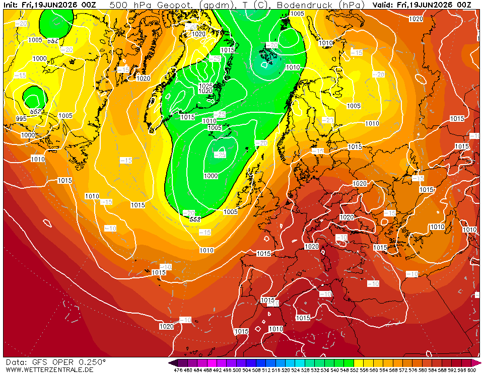
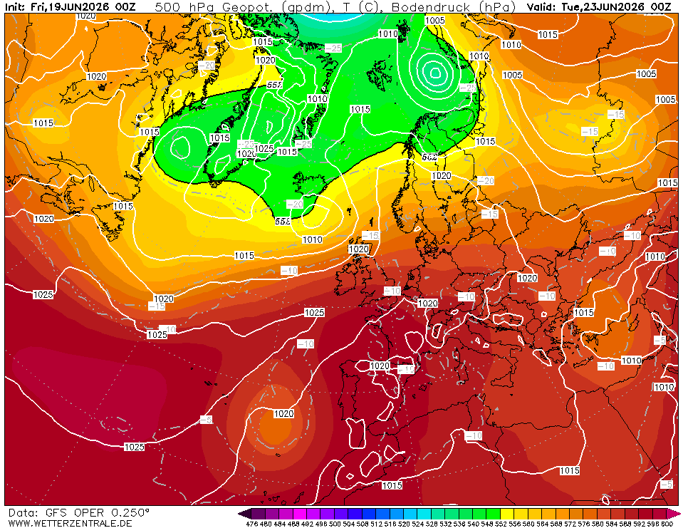
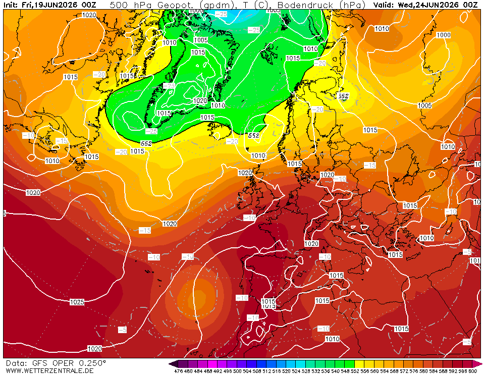
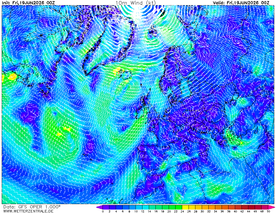
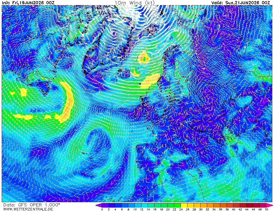
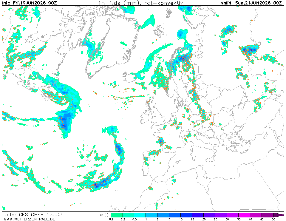
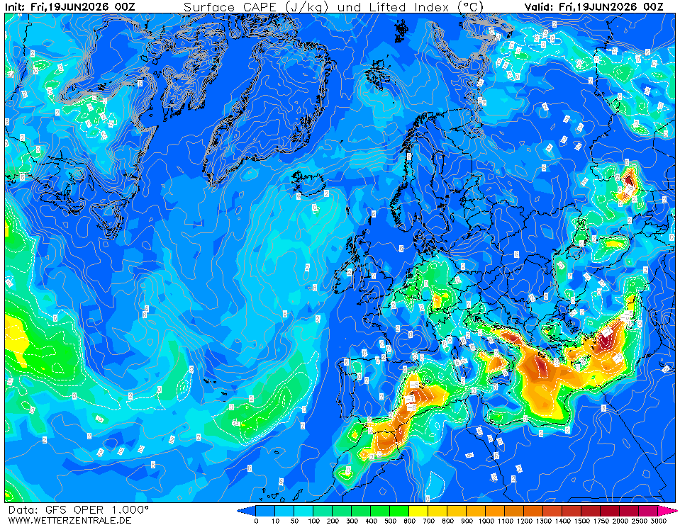
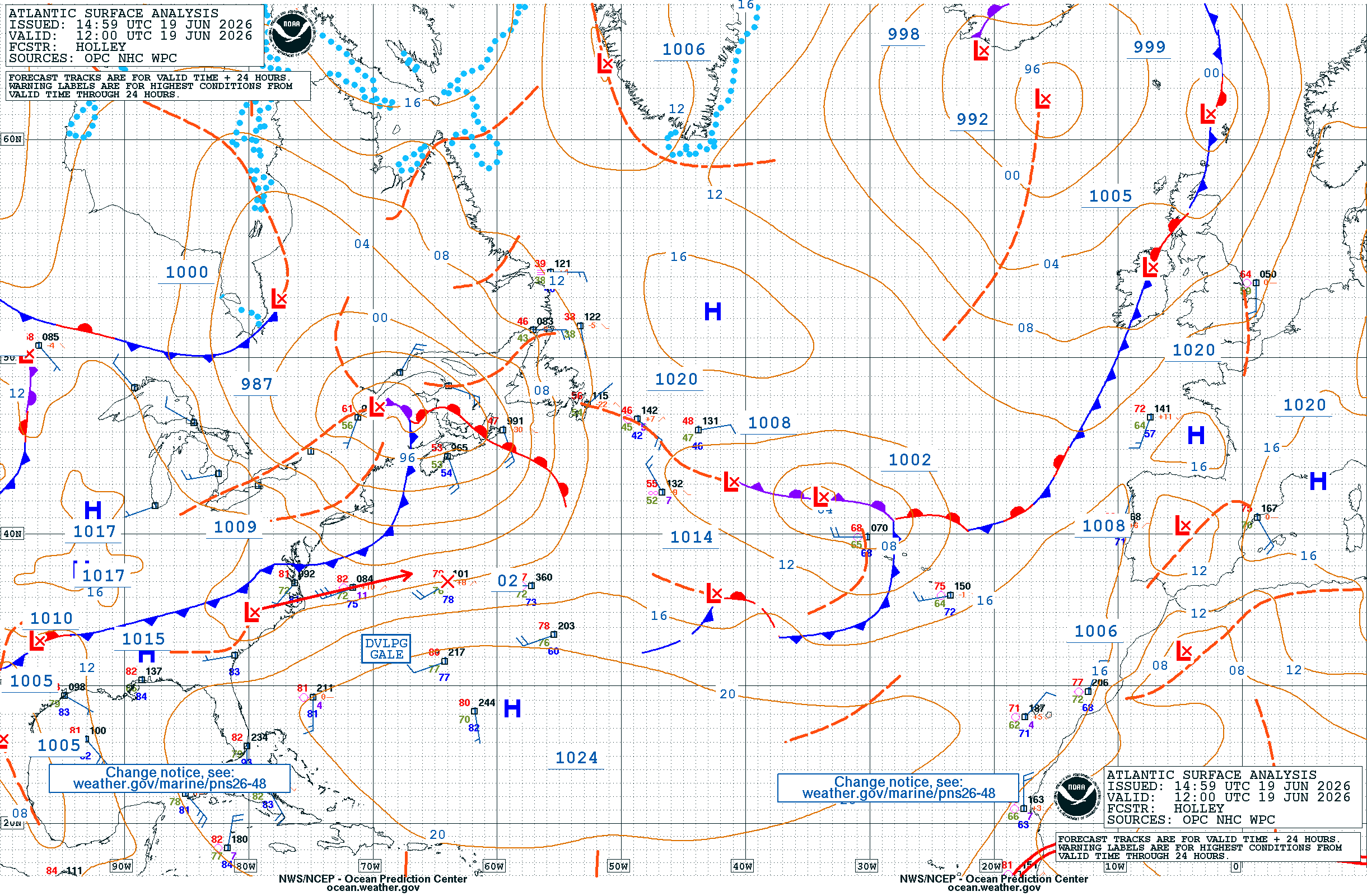
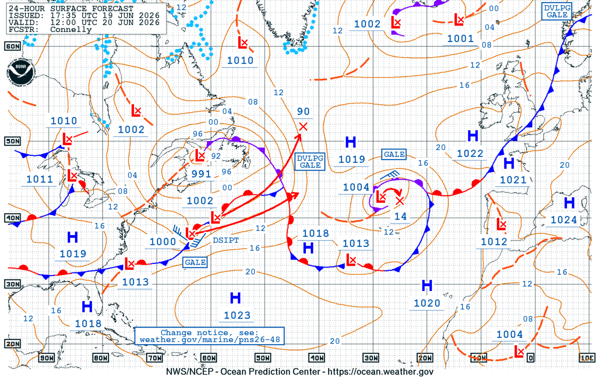
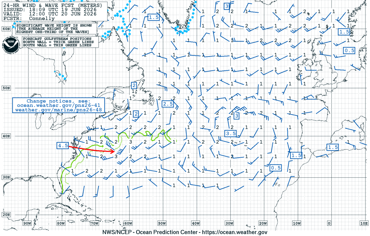
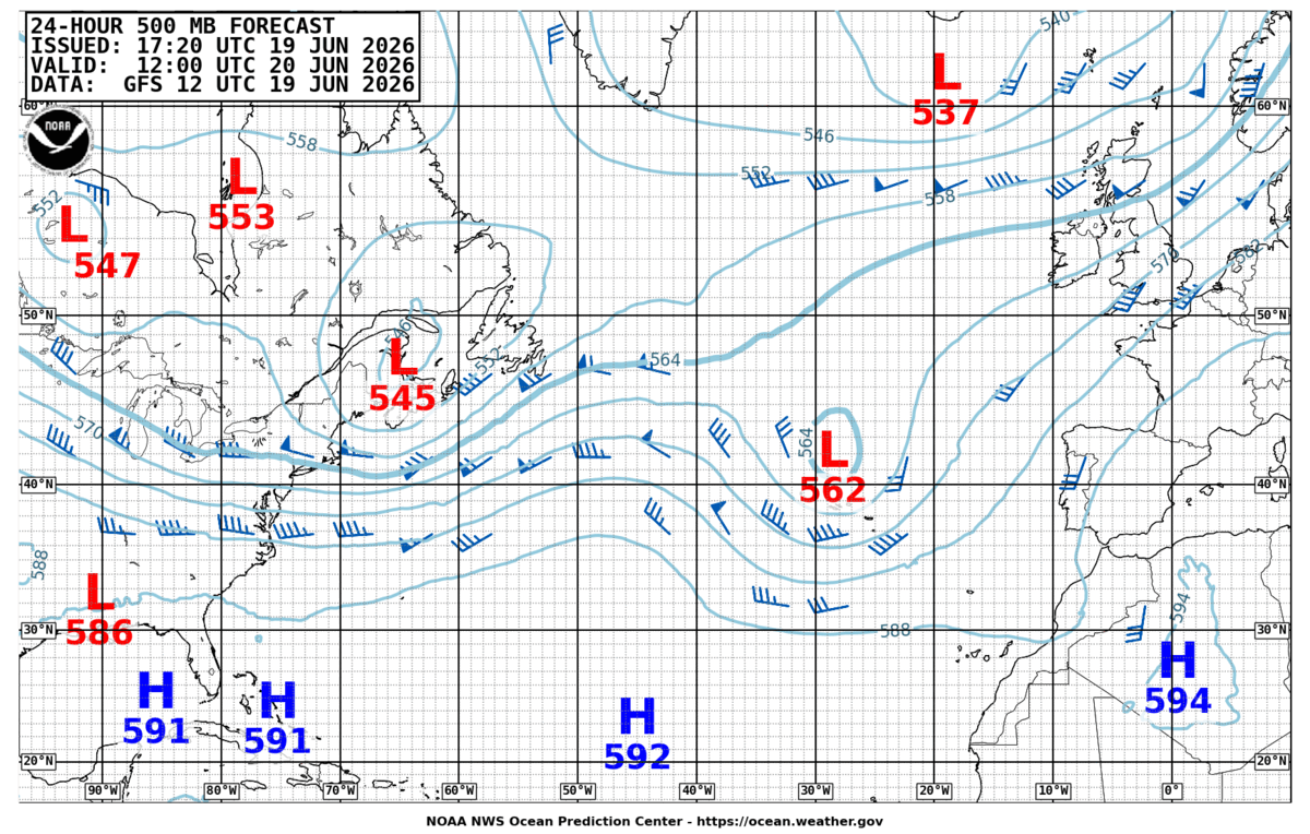
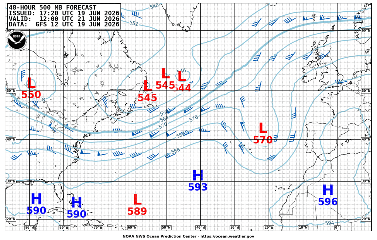
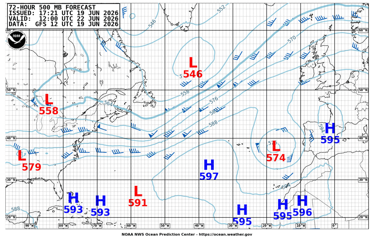
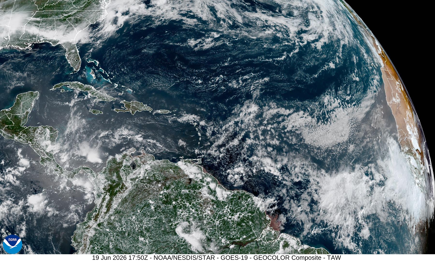
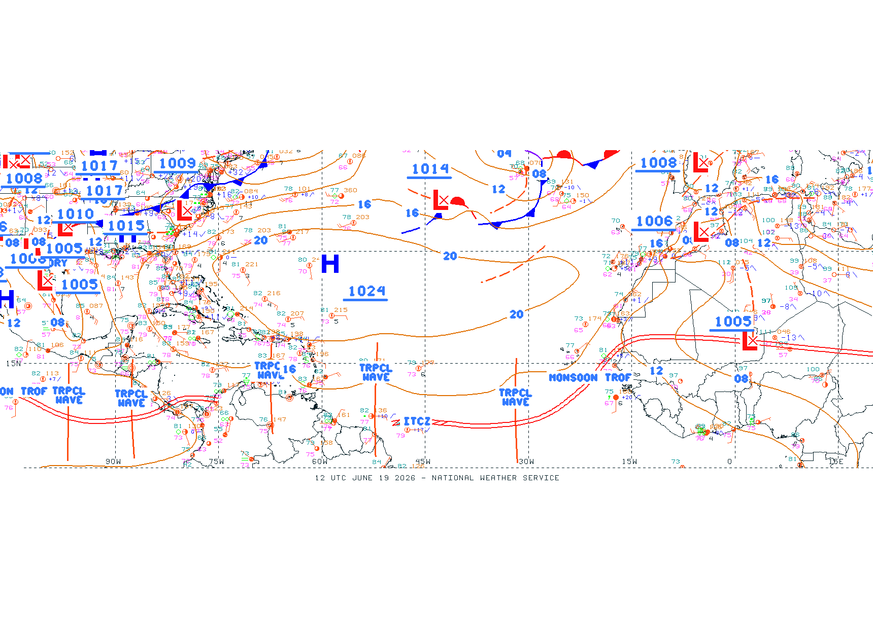
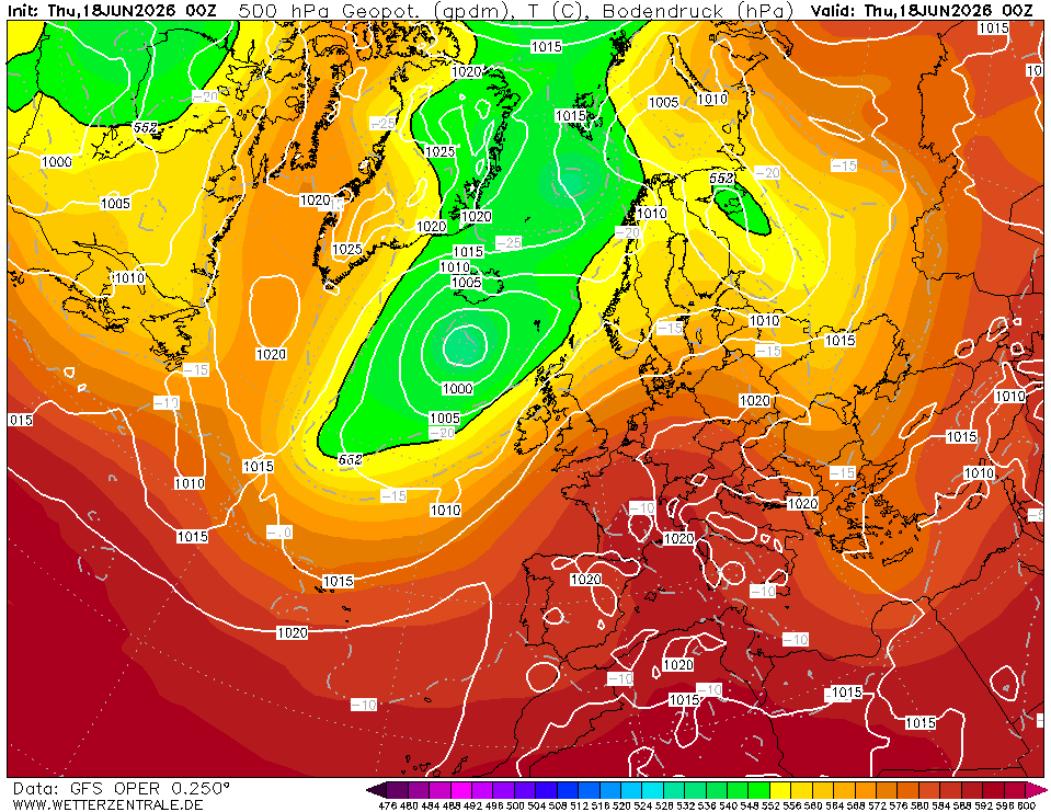
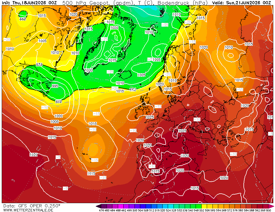
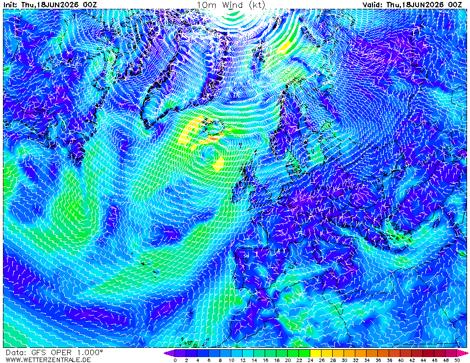
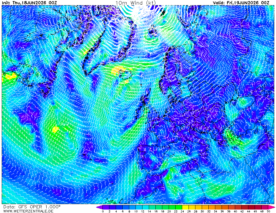
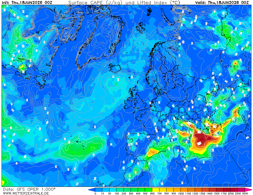
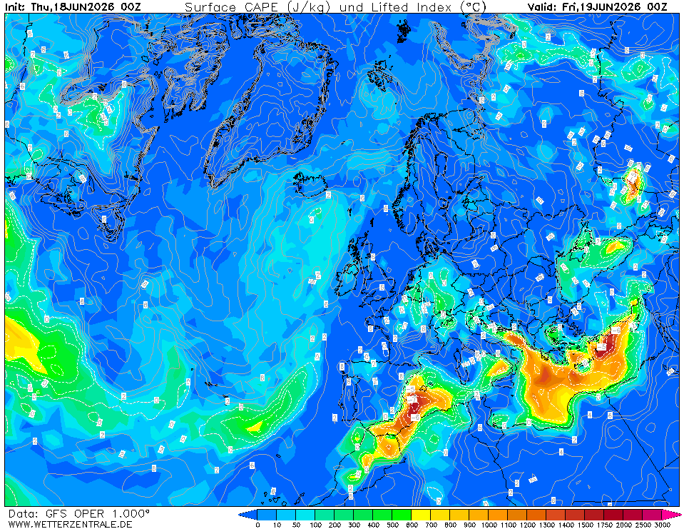
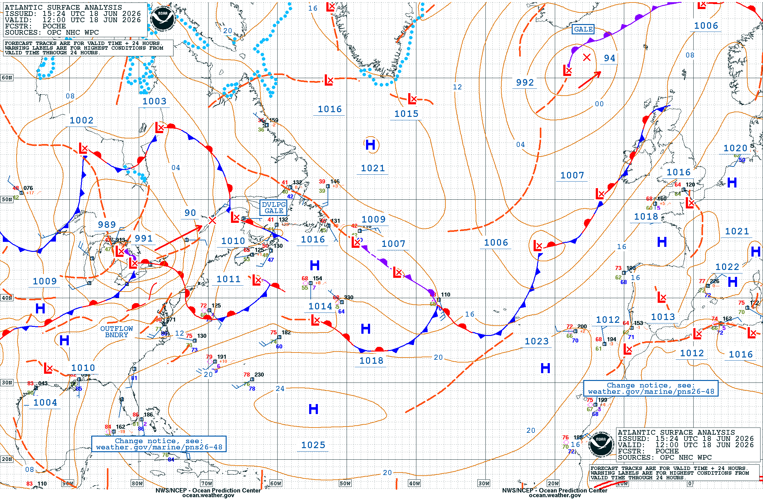
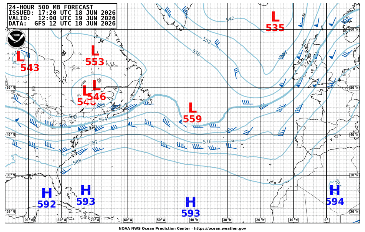
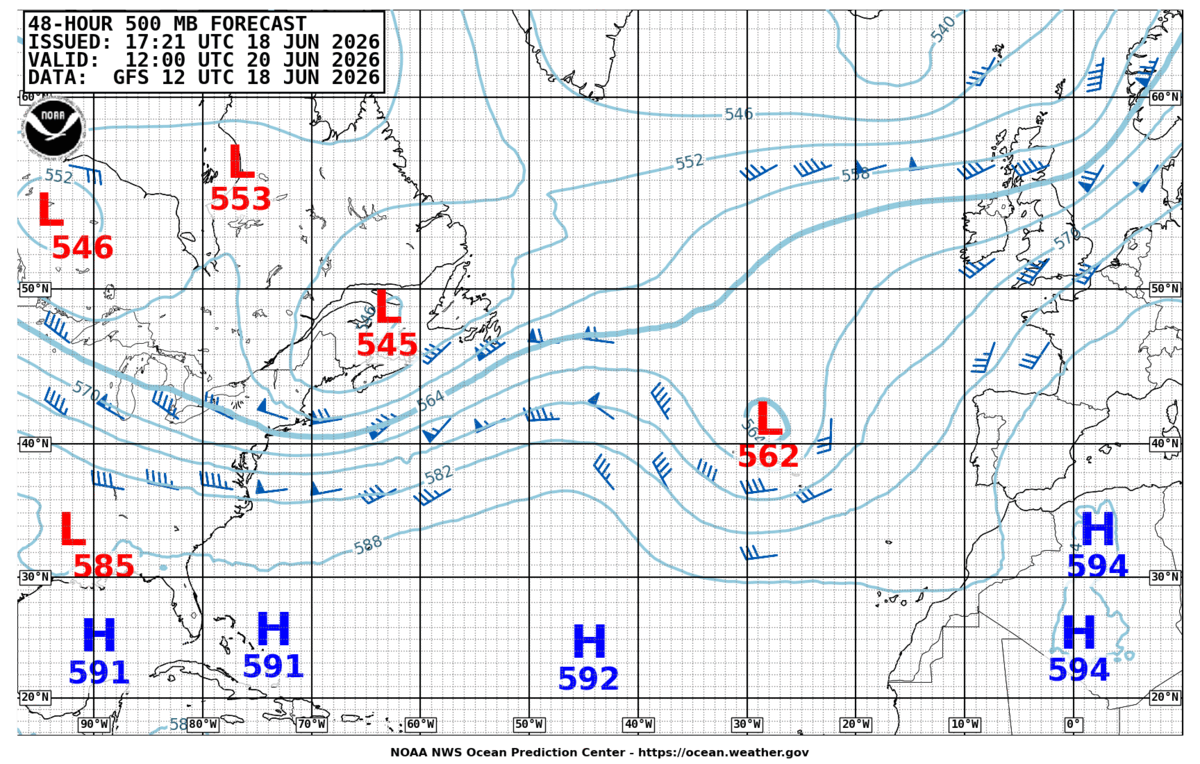
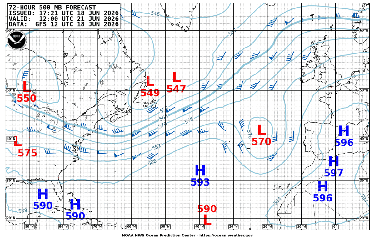
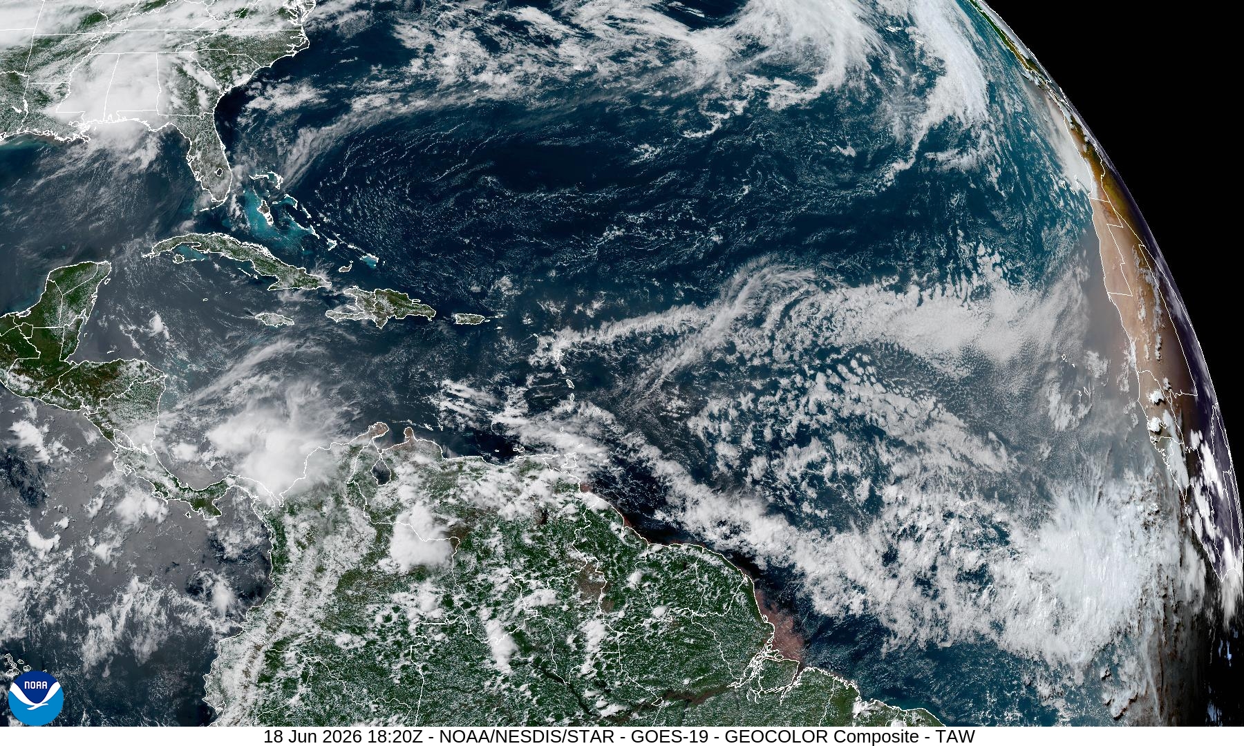
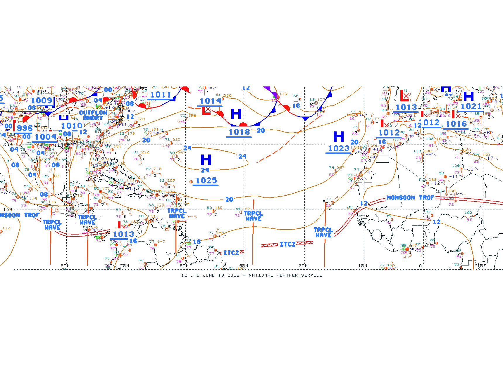
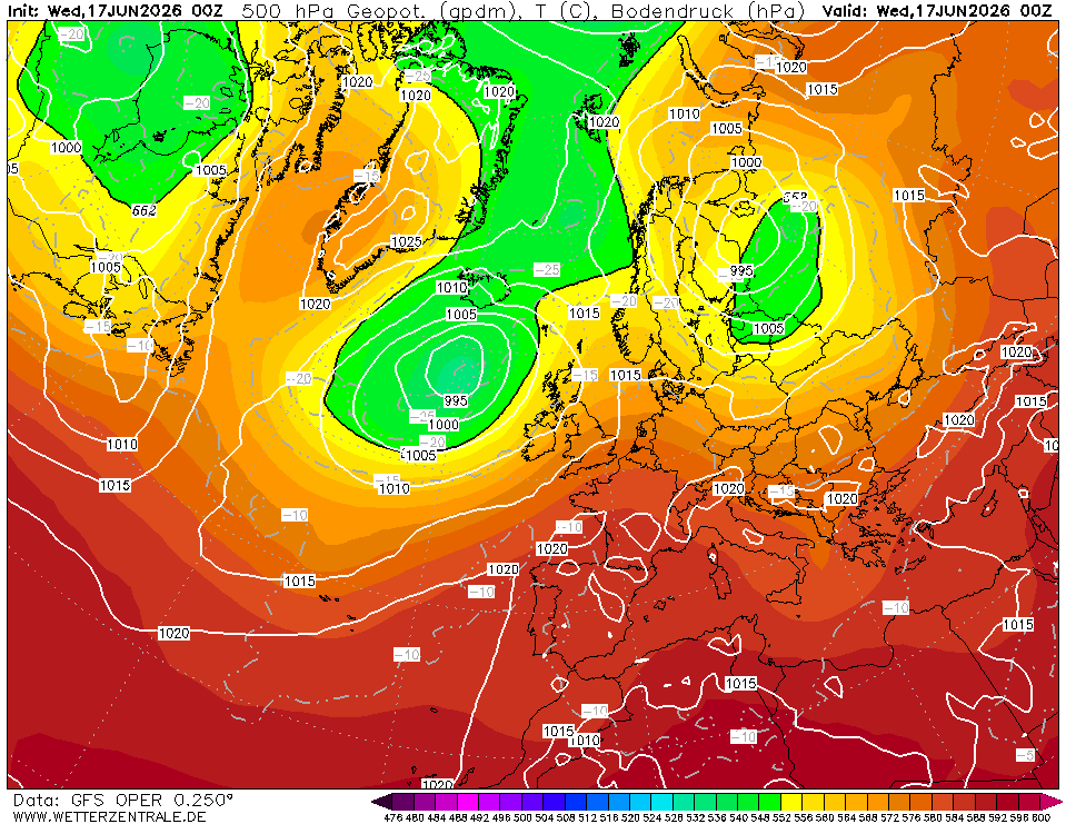
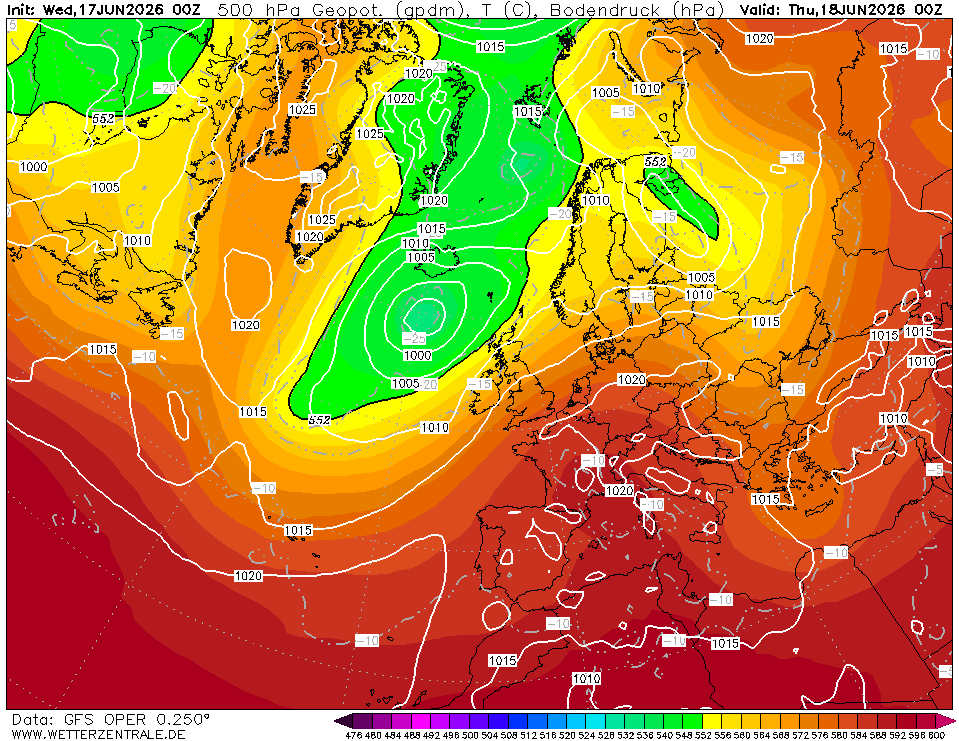
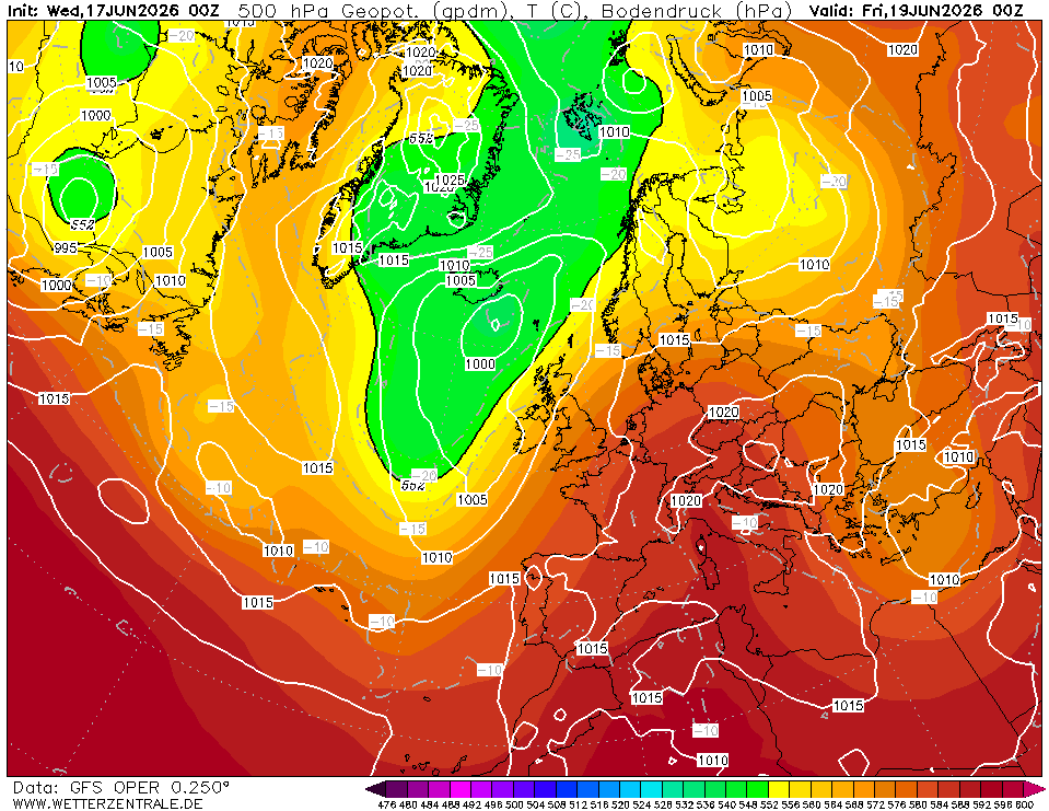
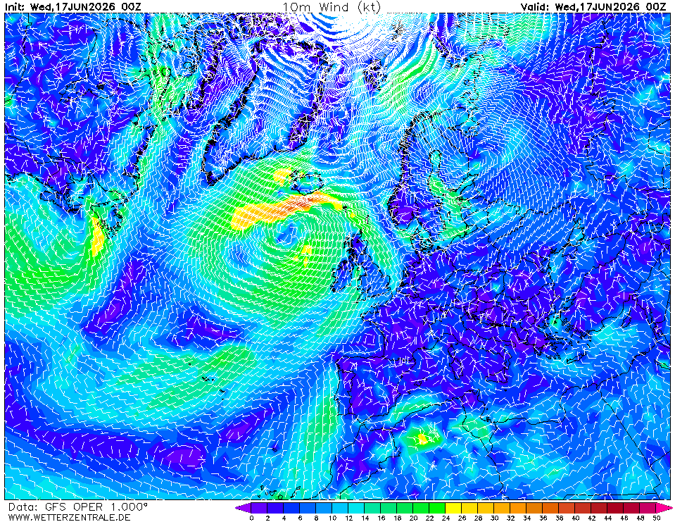
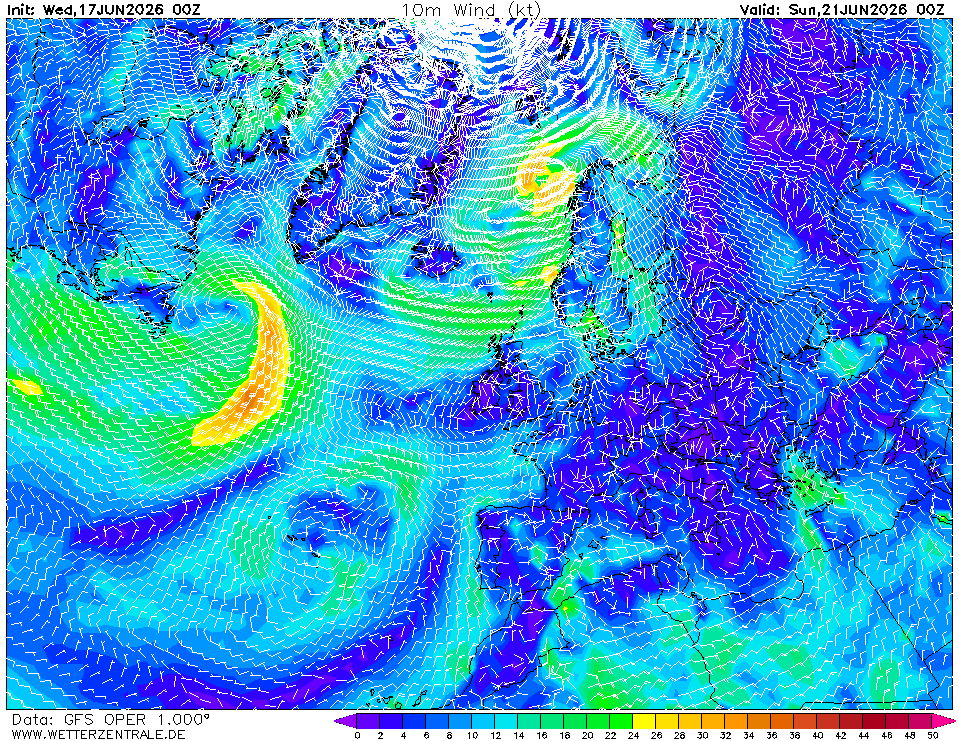
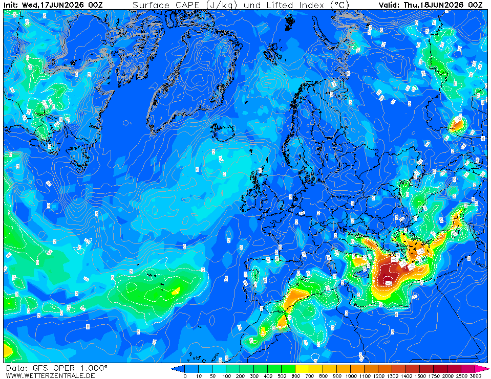
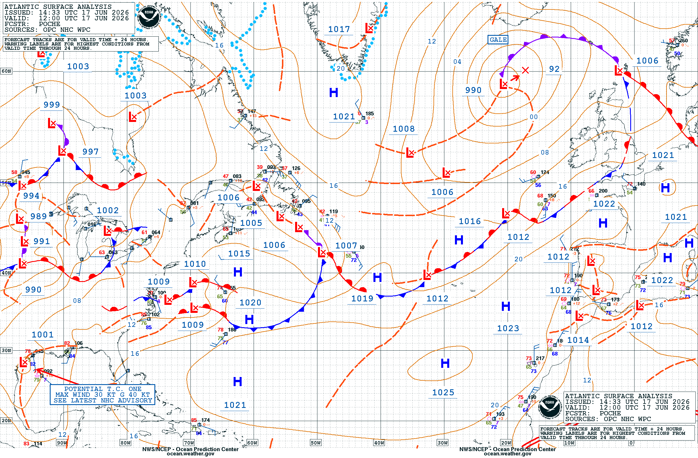
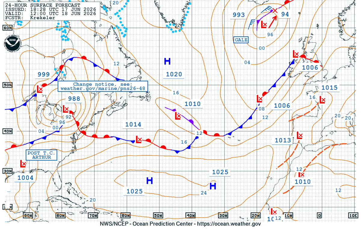
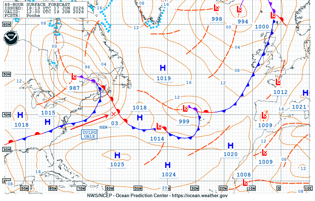
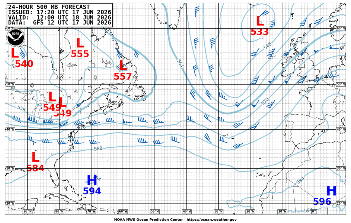
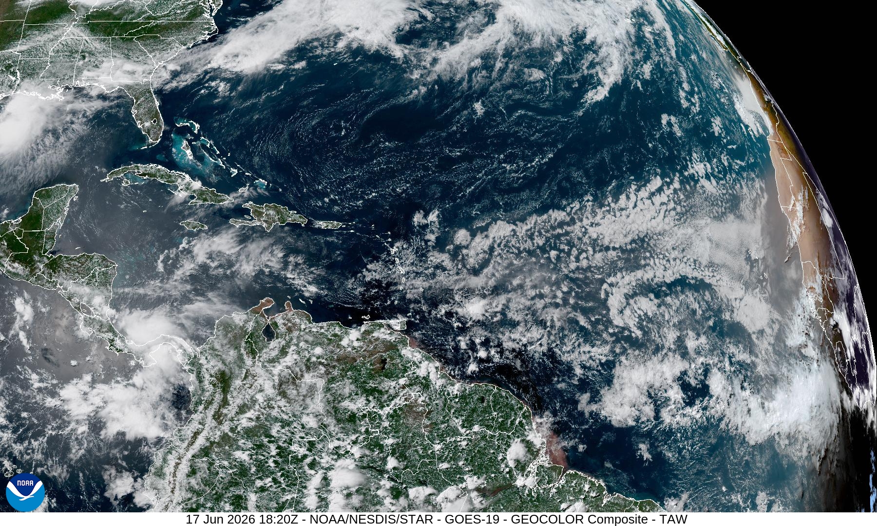
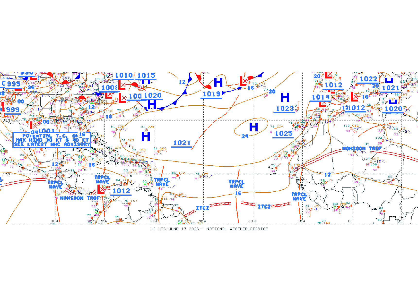
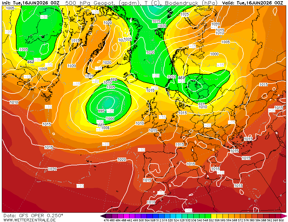
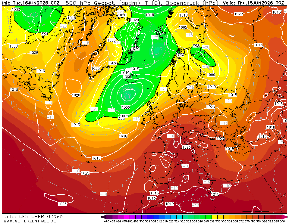
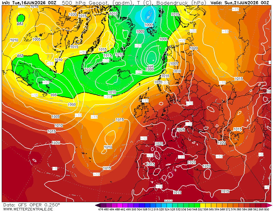
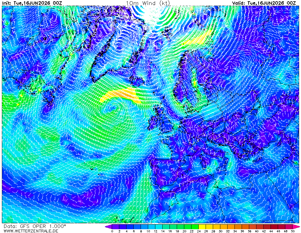
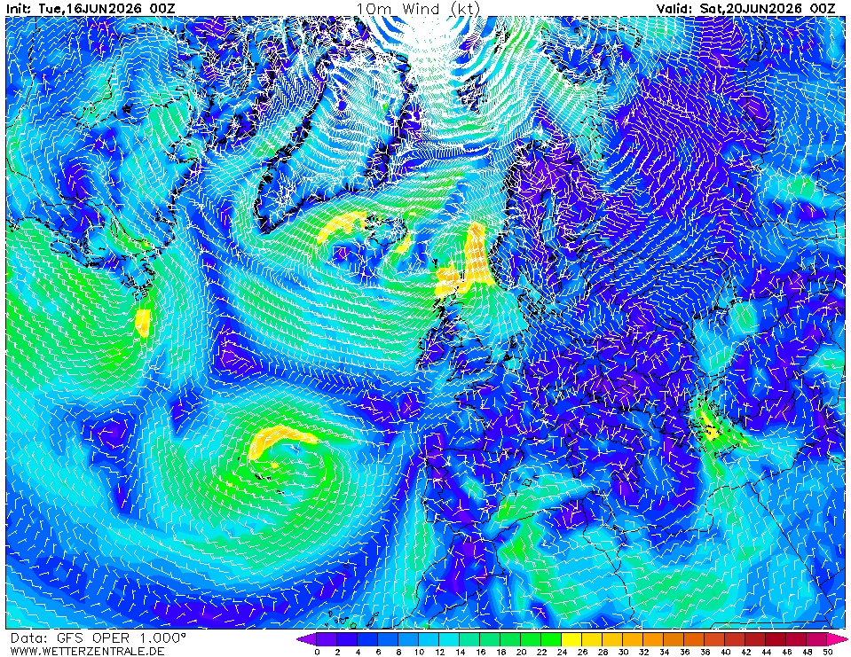
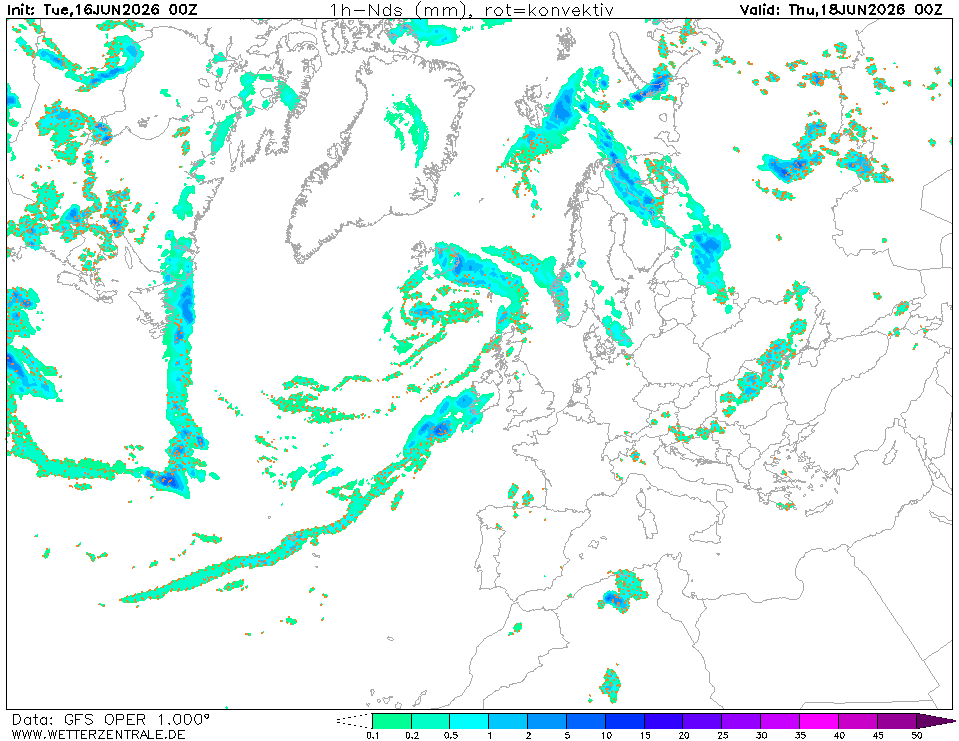
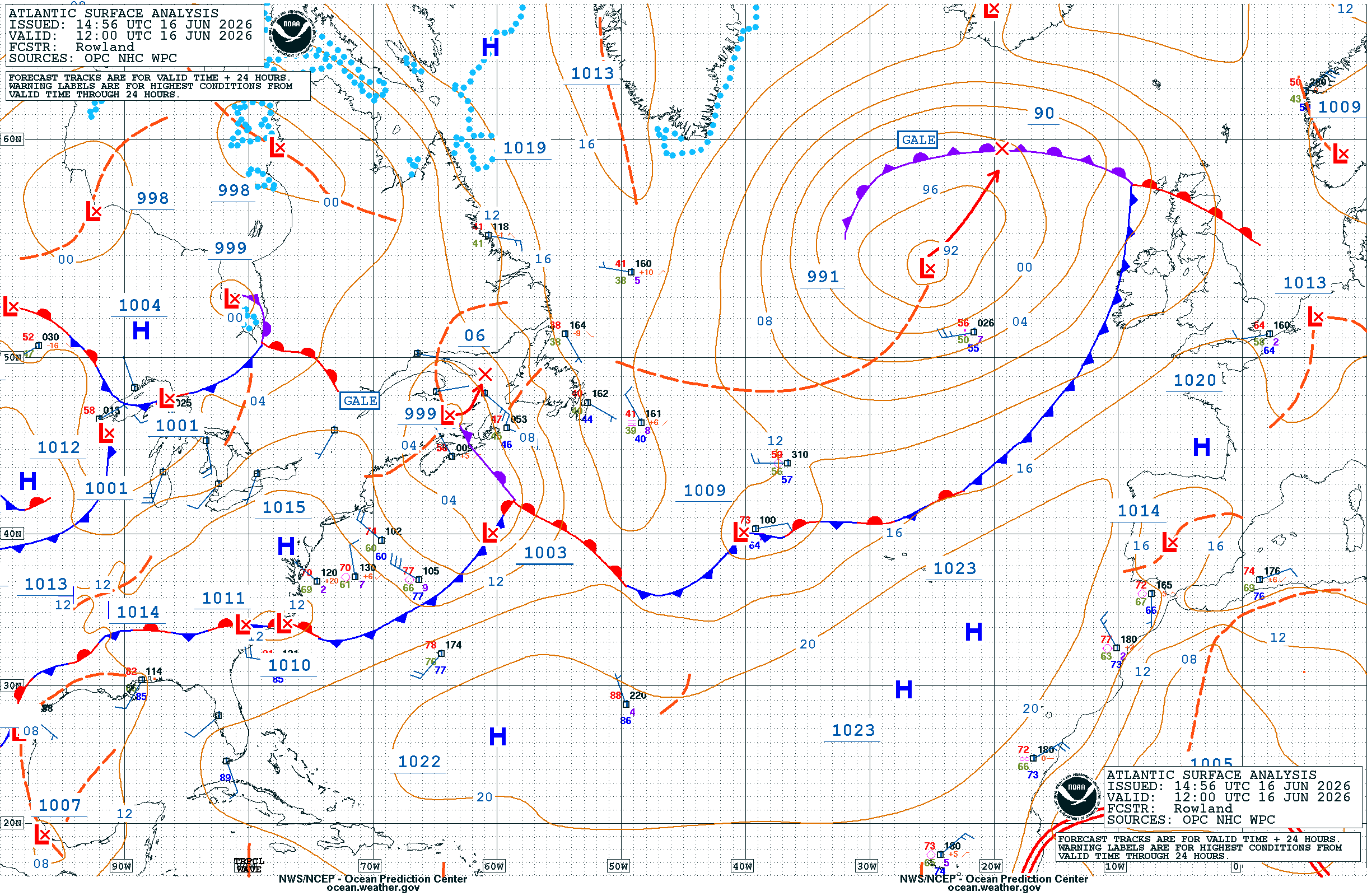
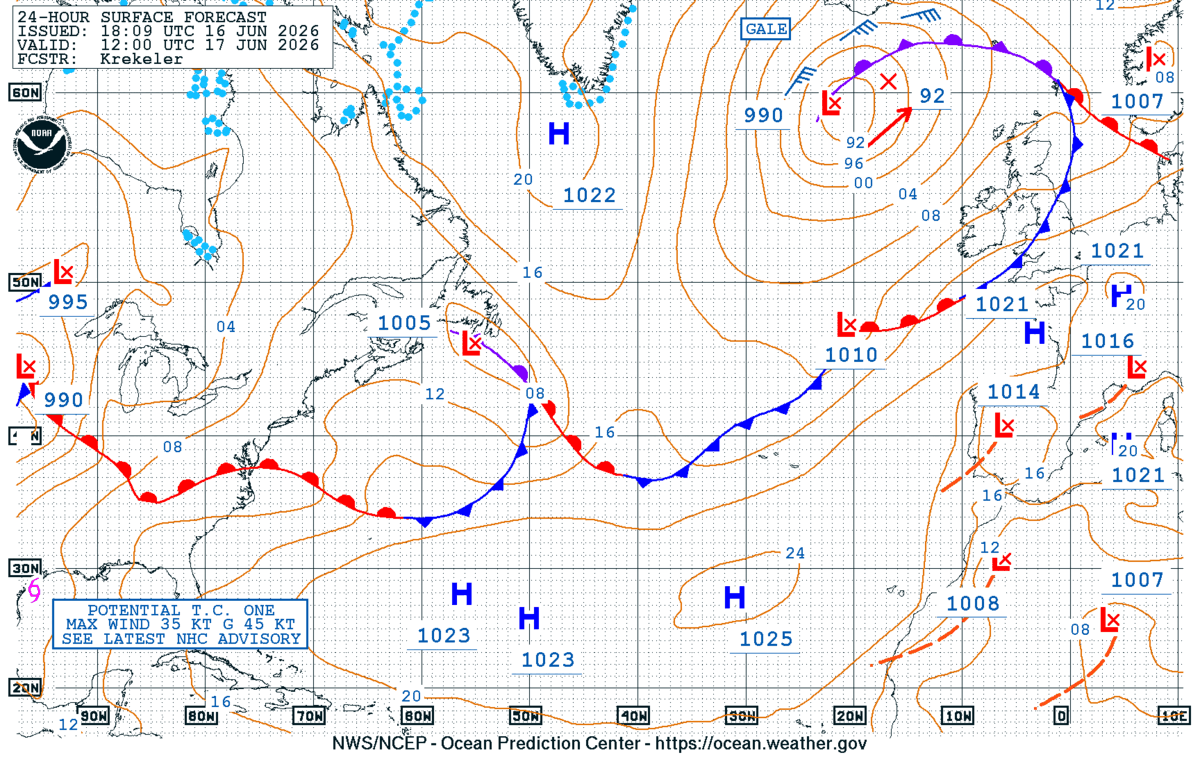
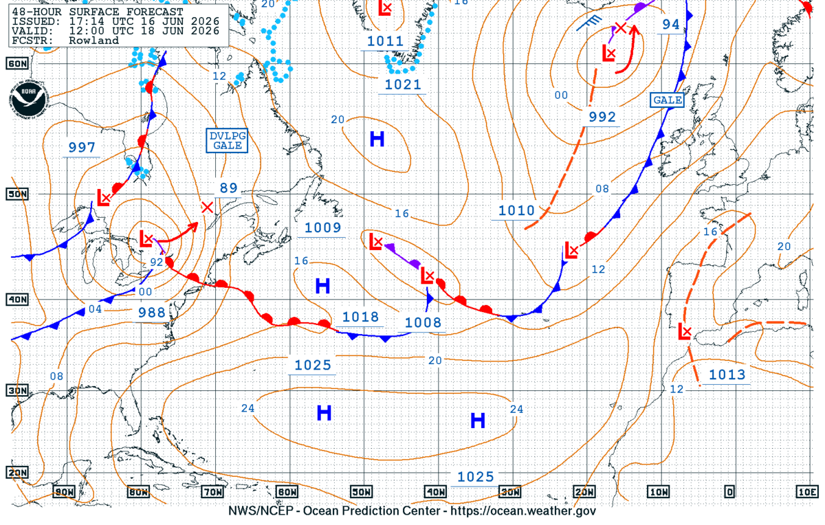
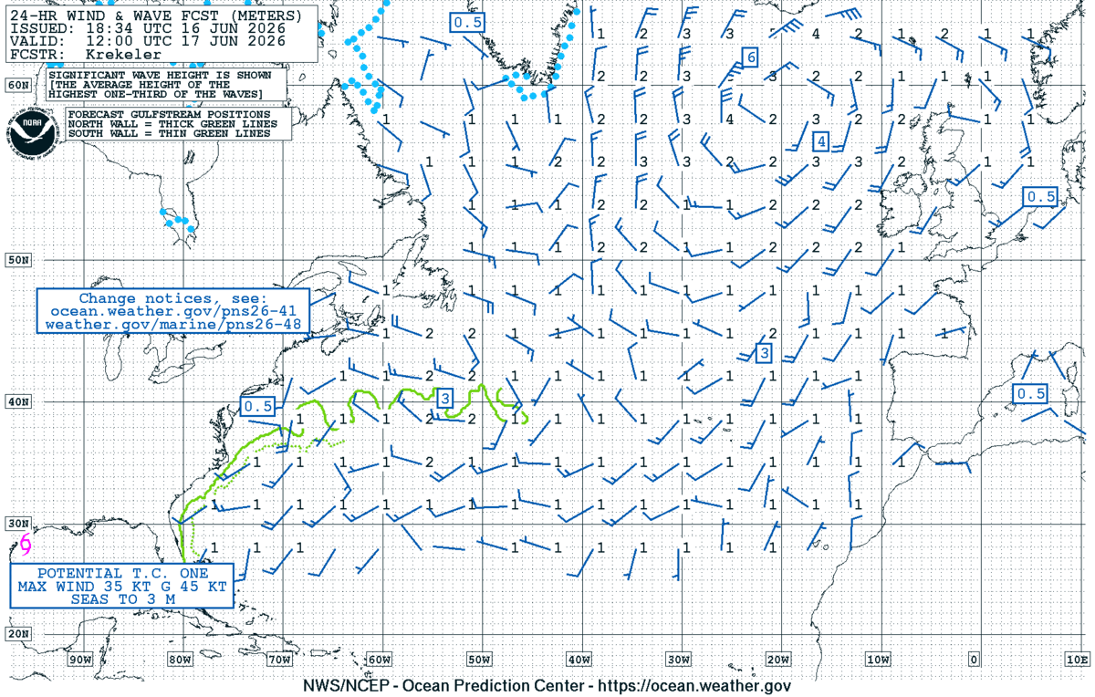
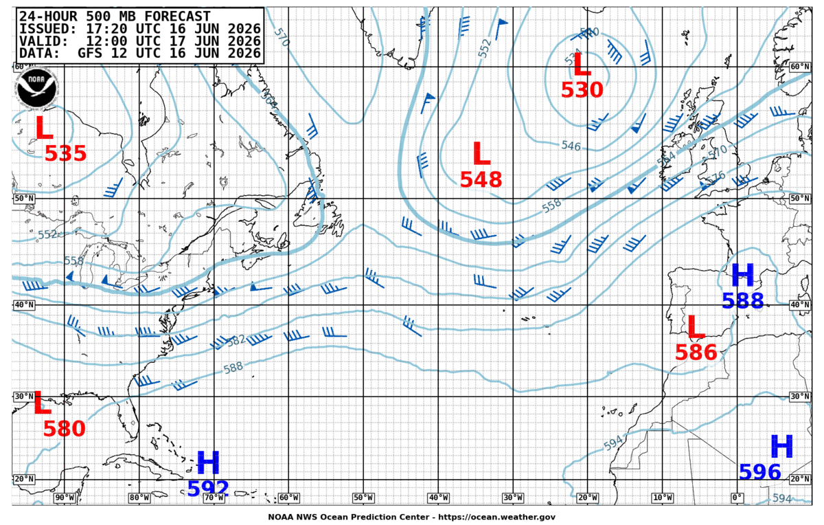
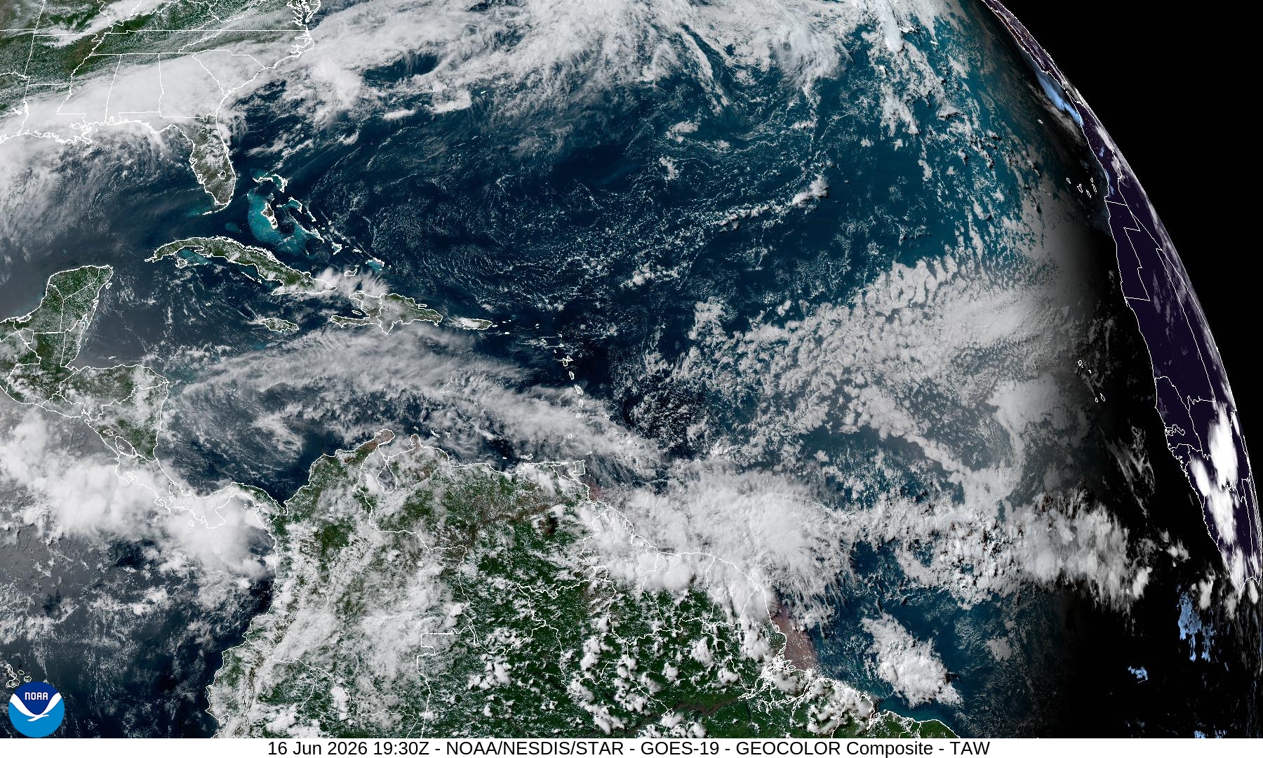
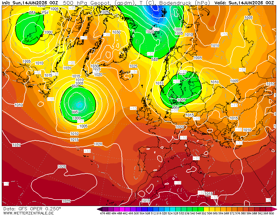
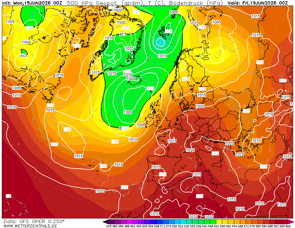
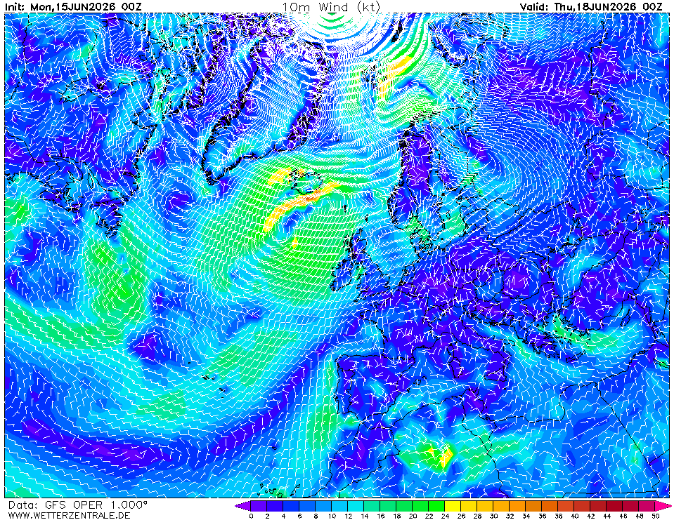
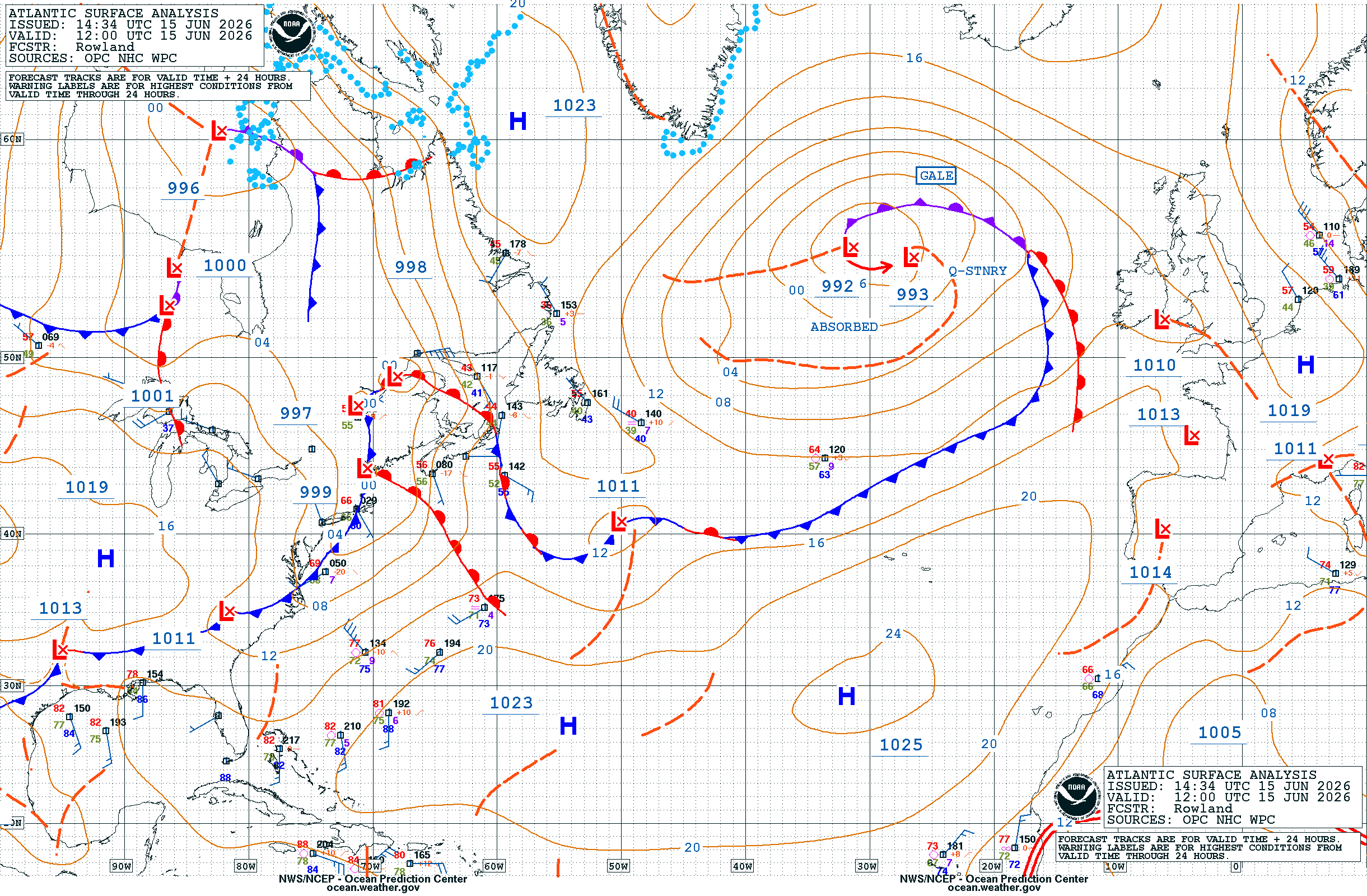
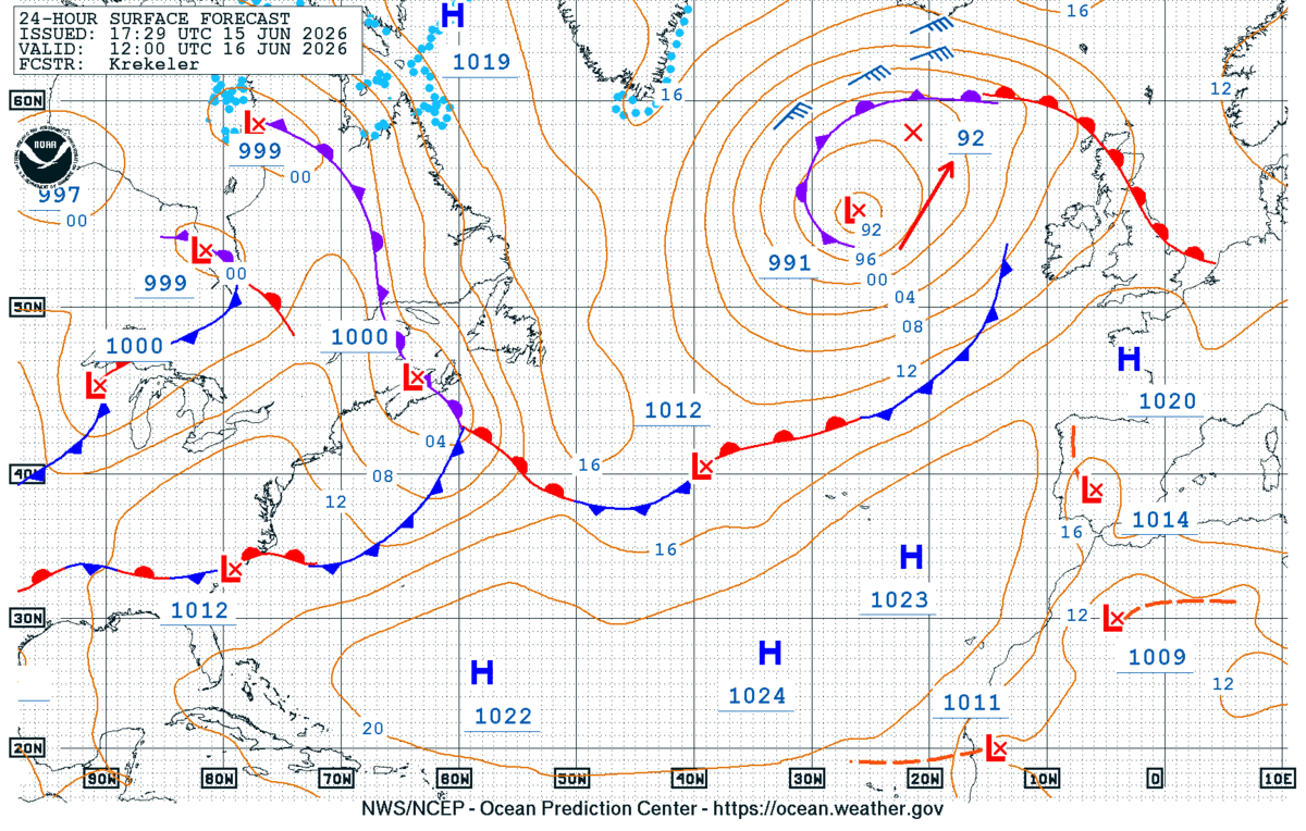
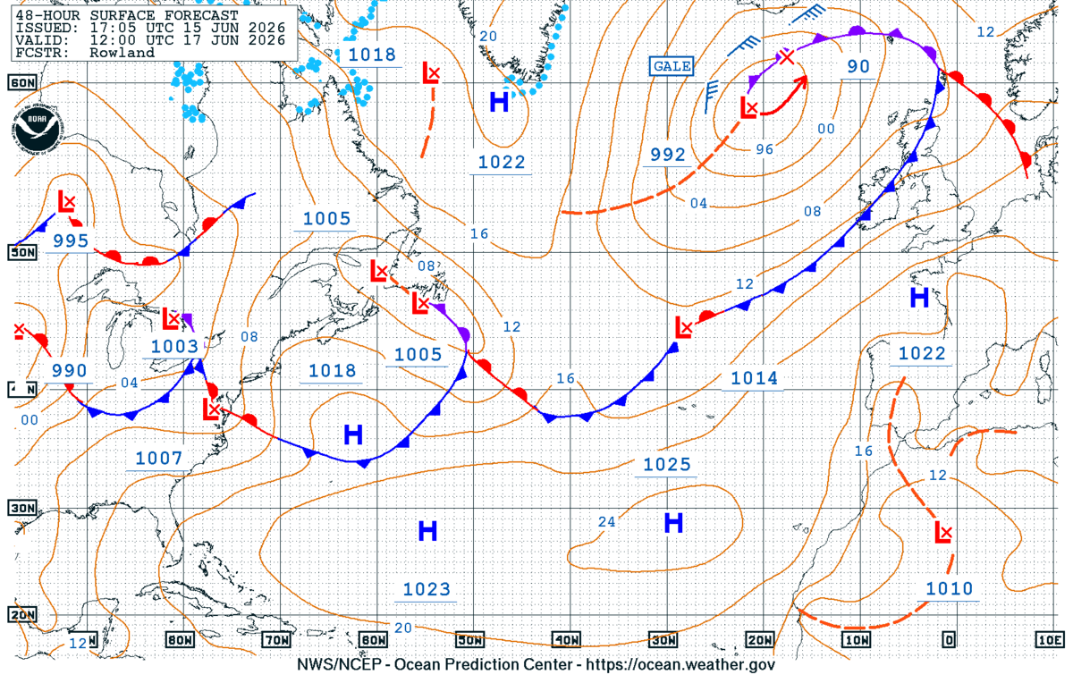
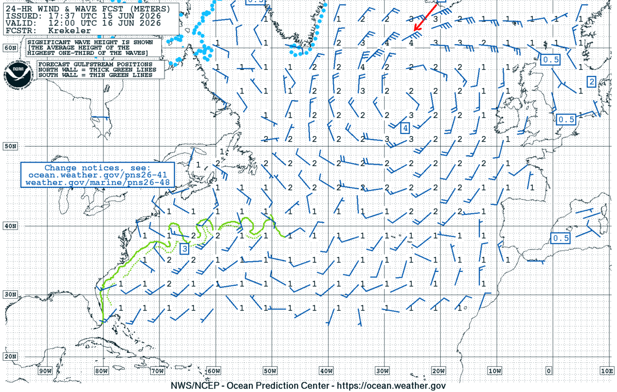
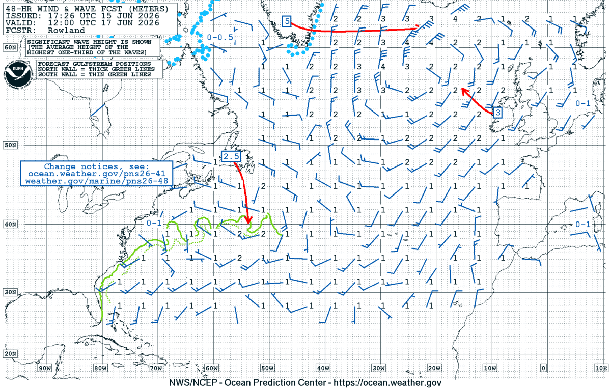
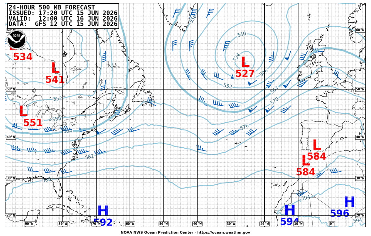
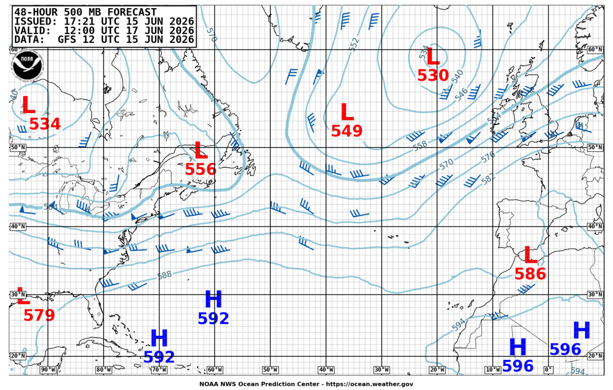
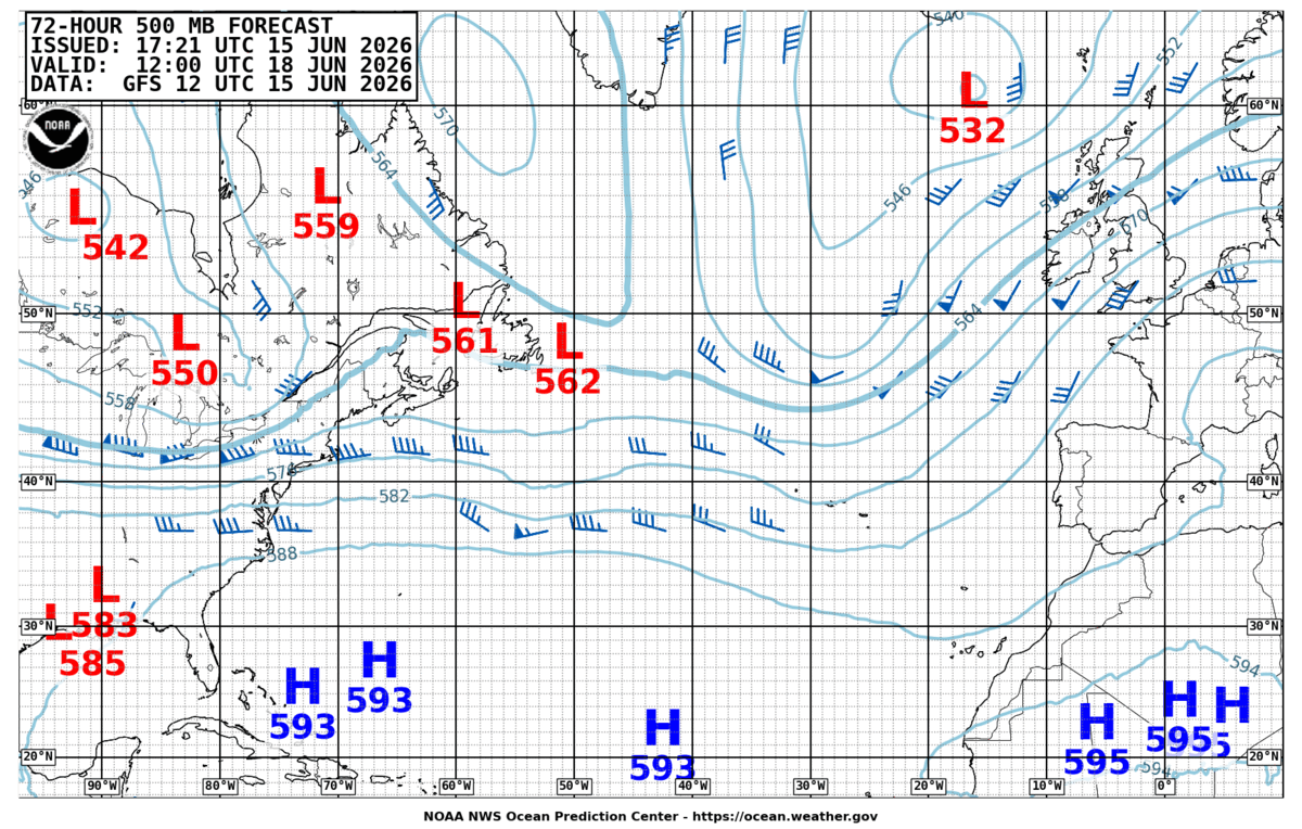
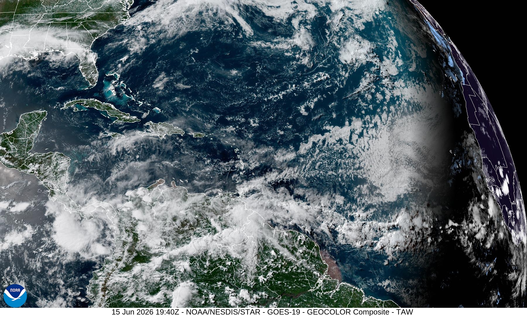
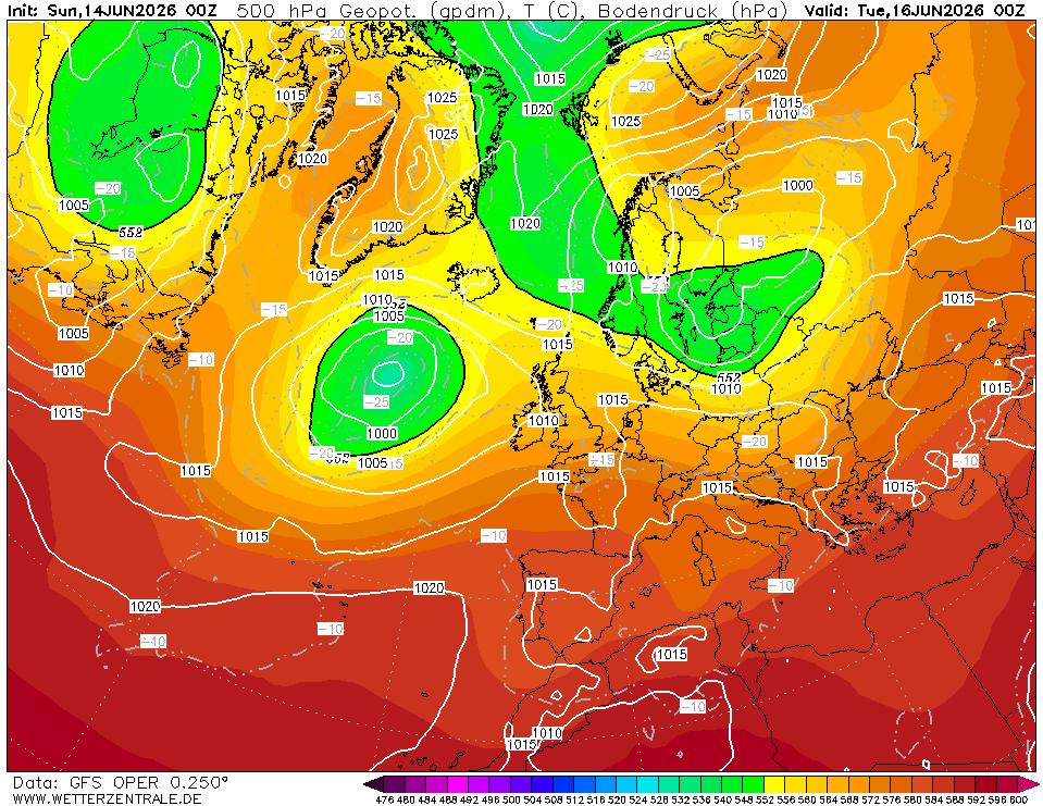
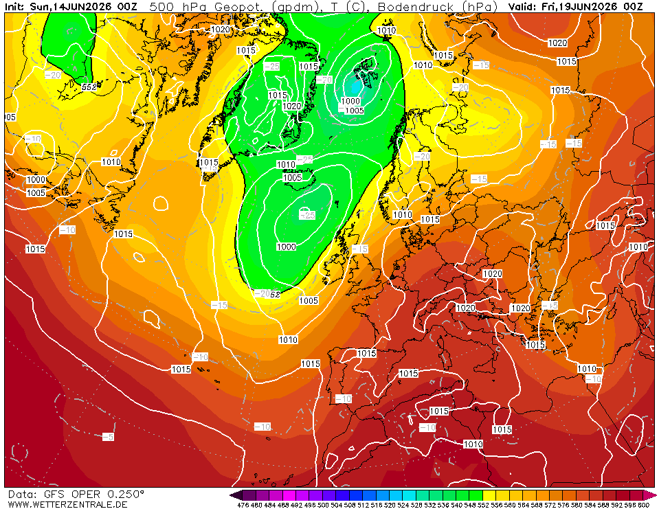
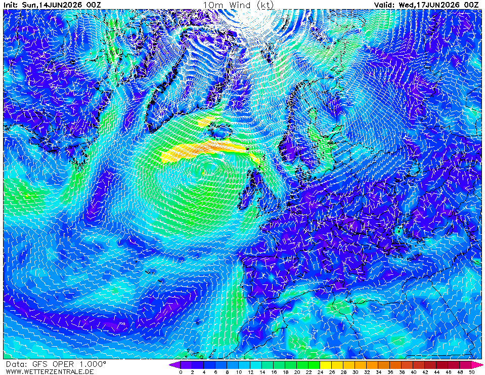
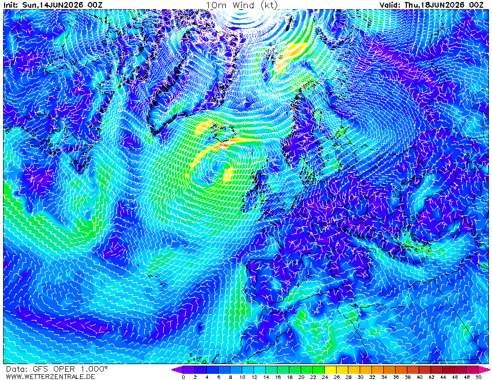
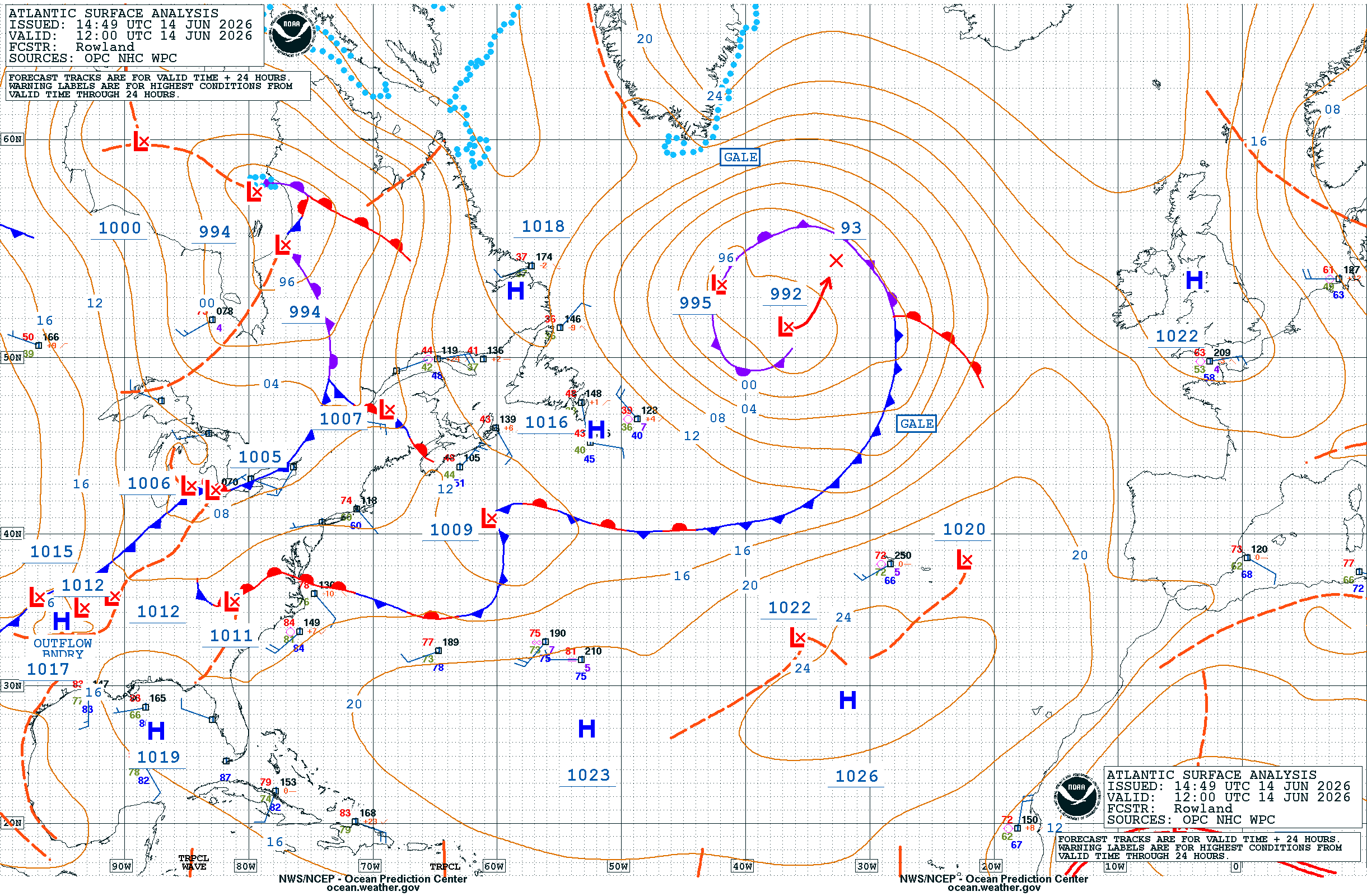
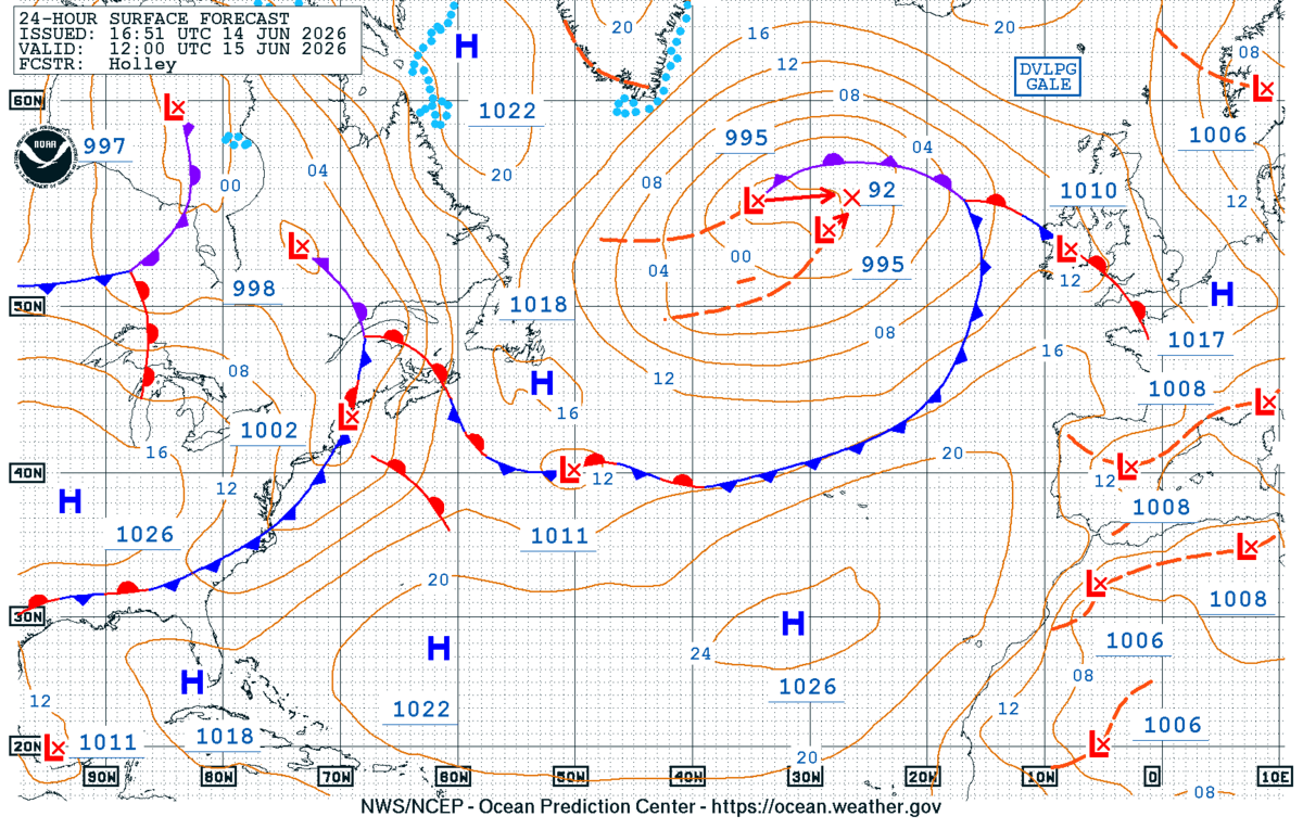
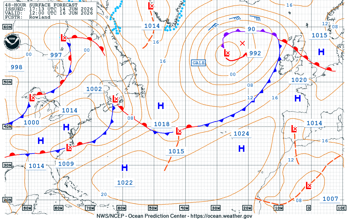
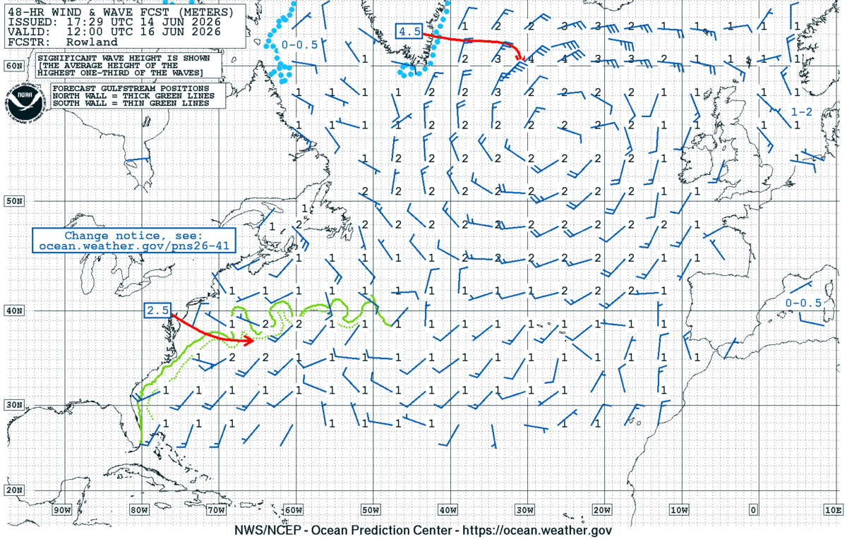
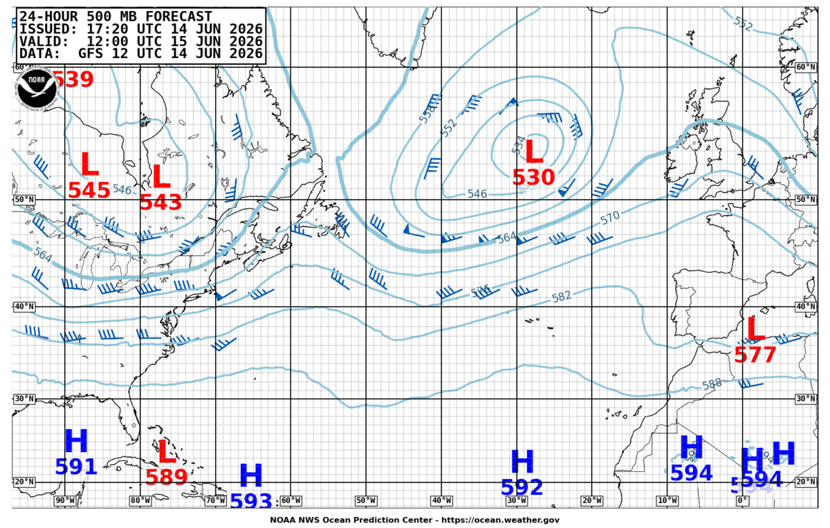
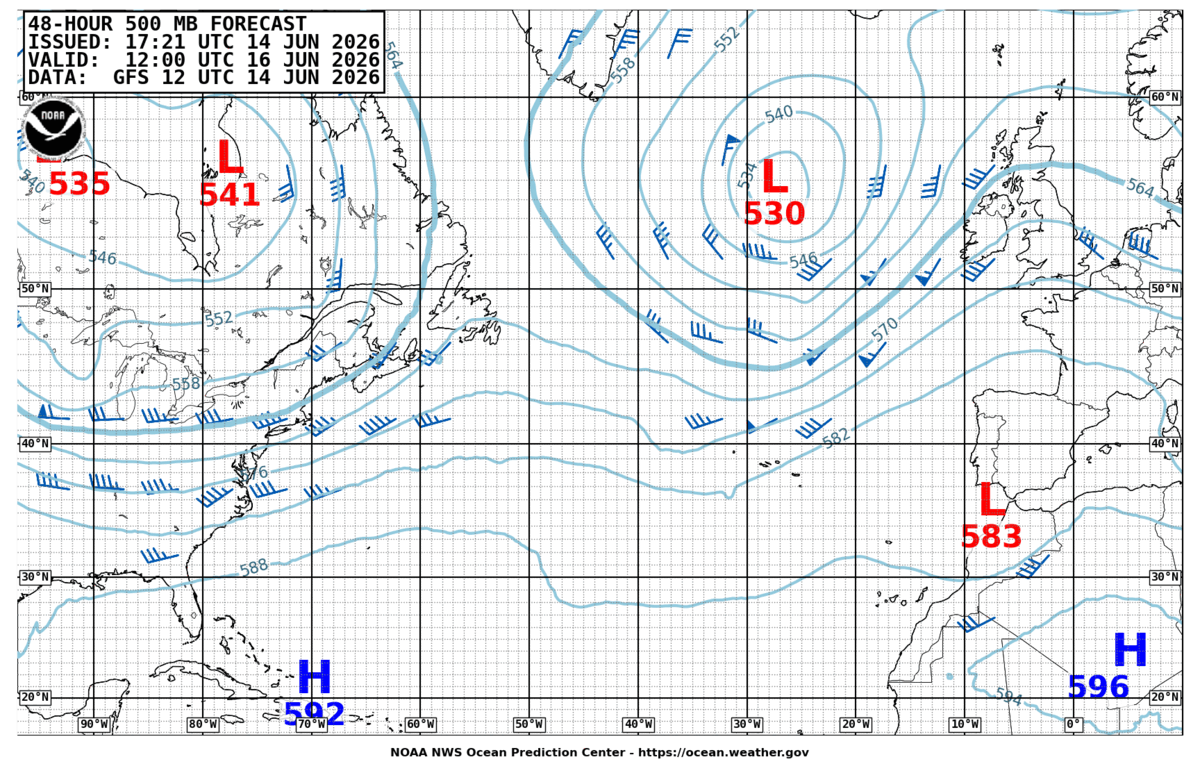
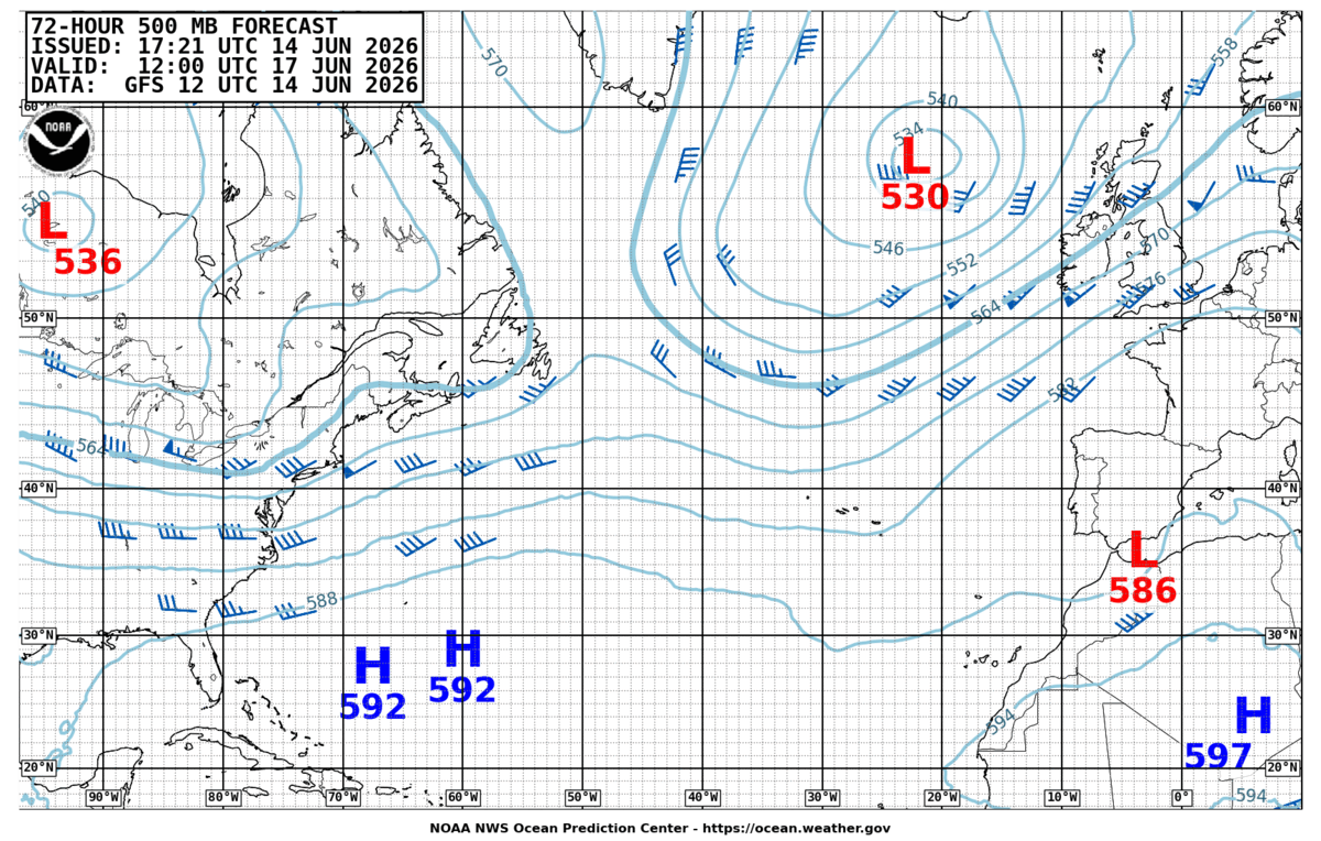
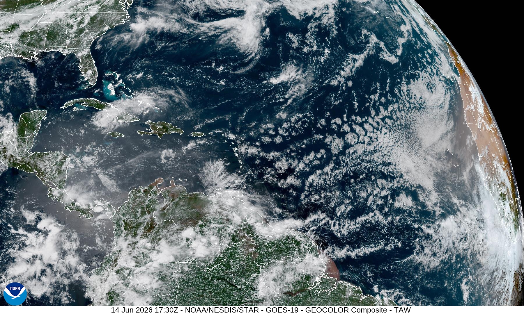
A broad Azores High (1025 hPa centred near 35°N 25°W, Chart 1) dominates the eastern Atlantic and extends a ridge over Iberia (1020 hPa). To the north, a deep cut-off low sits south of Iceland (~995 hPa, 552 dam 500 hPa trough overhead) with an associated frontal system draped across the British Isles into the western Approaches. The Bay of Biscay lies in the slack gradient between these features — surface pressure 1015–1020 hPa, light to moderate westerlies (Chart 4 shows 8–14 kt across Biscay, 14–18 kt off Finisterre). Satellite (Chart 8) confirms cloud bands sweeping NW Europe but clear skies over Iberia and the Gulf of Cádiz. The Iceland low tracks slowly ENE; the Azores ridge holds firm.
72-hour outlook
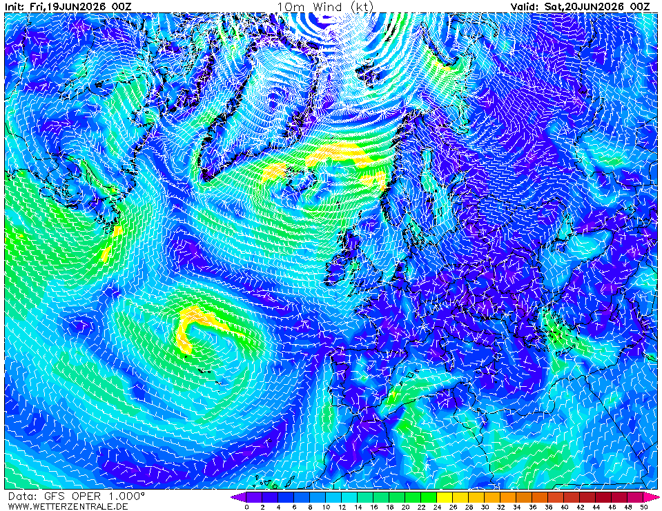
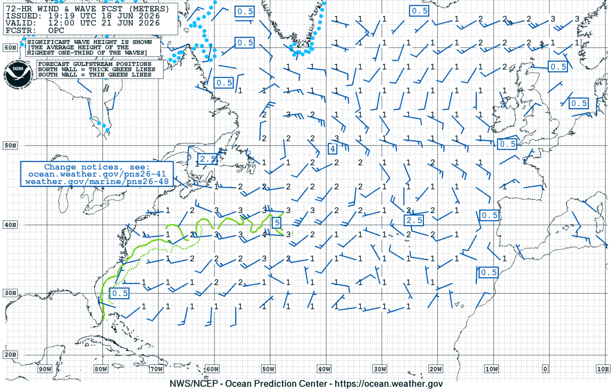
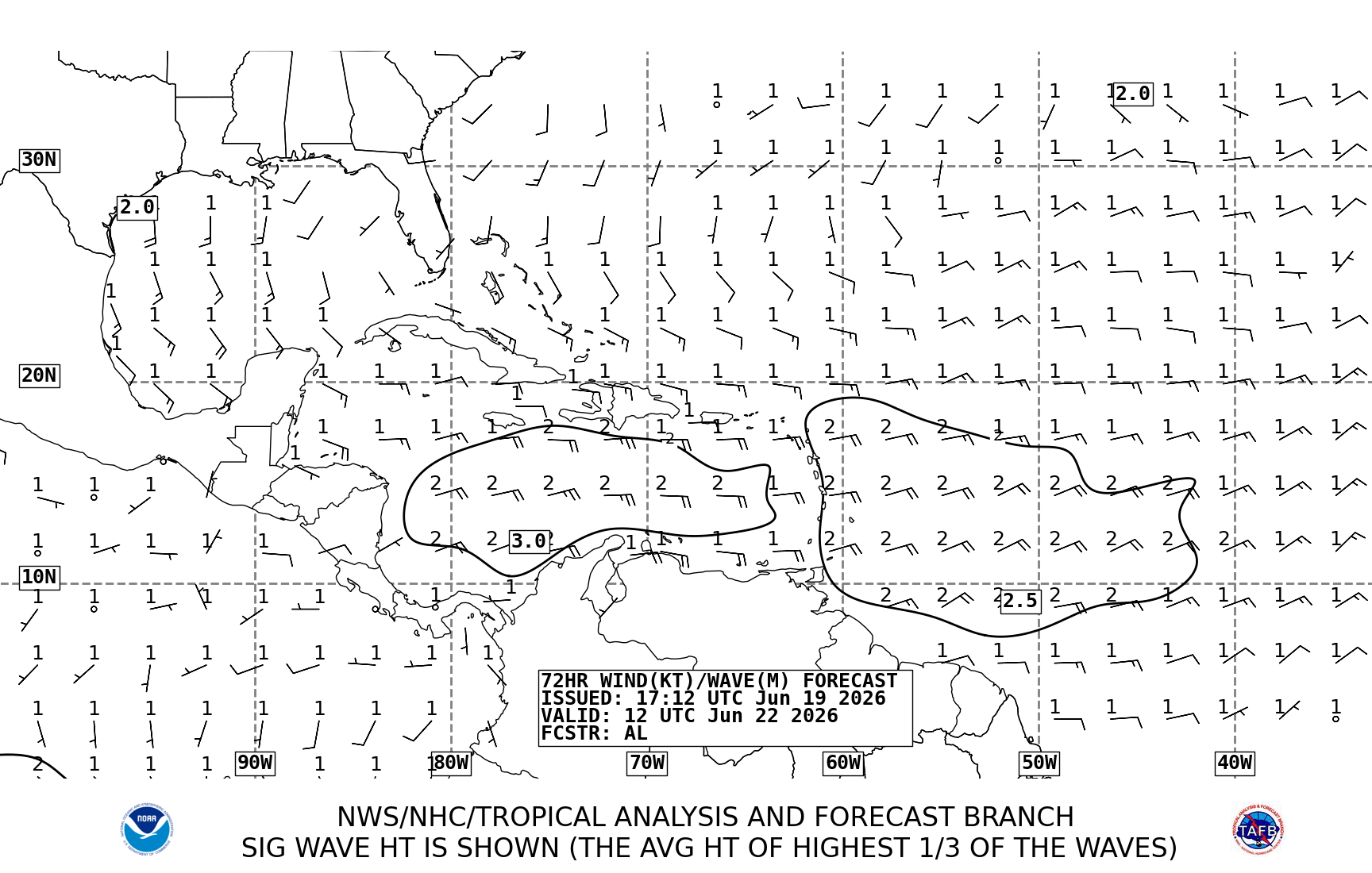
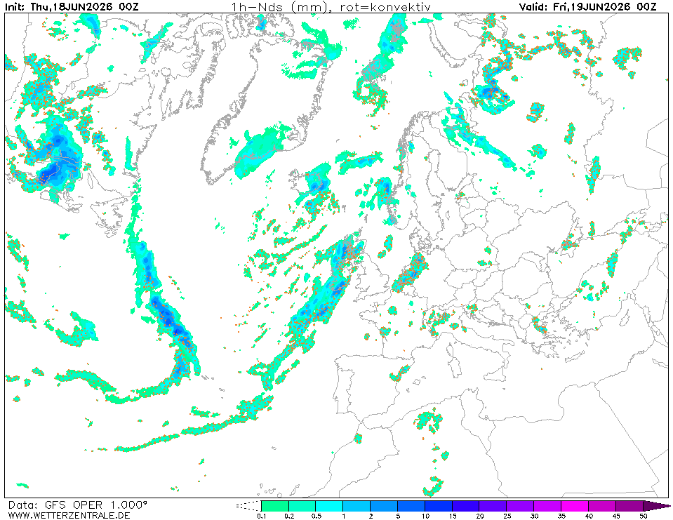
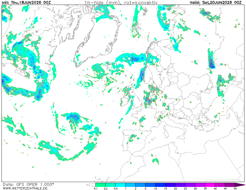
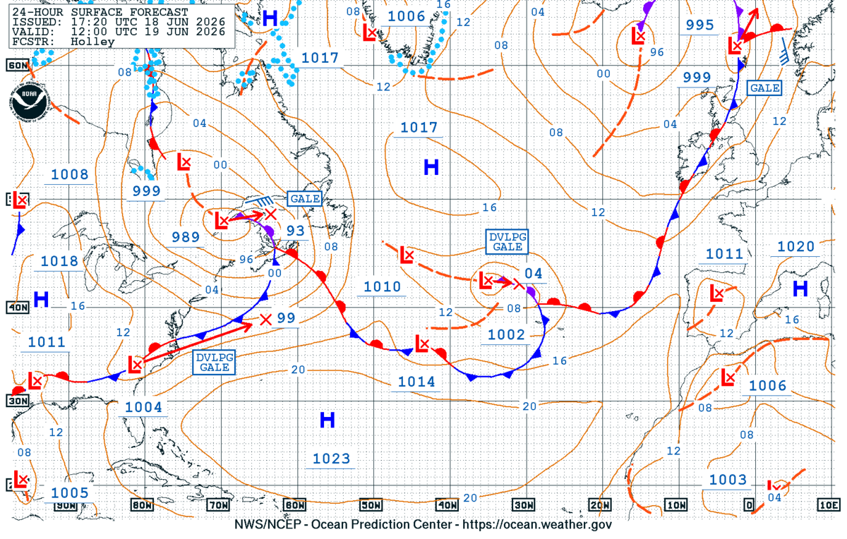
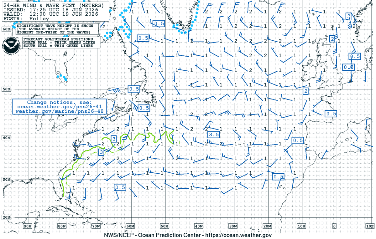
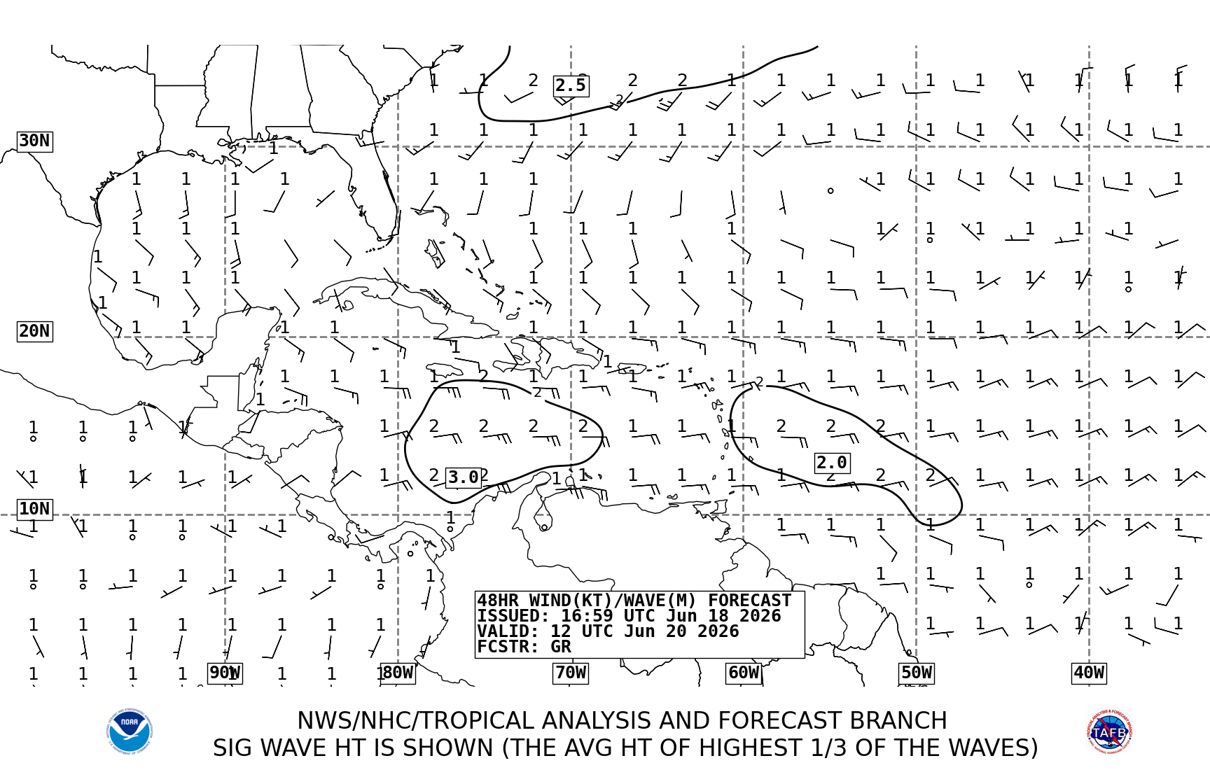
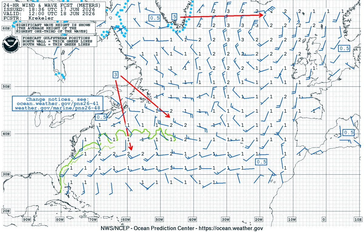
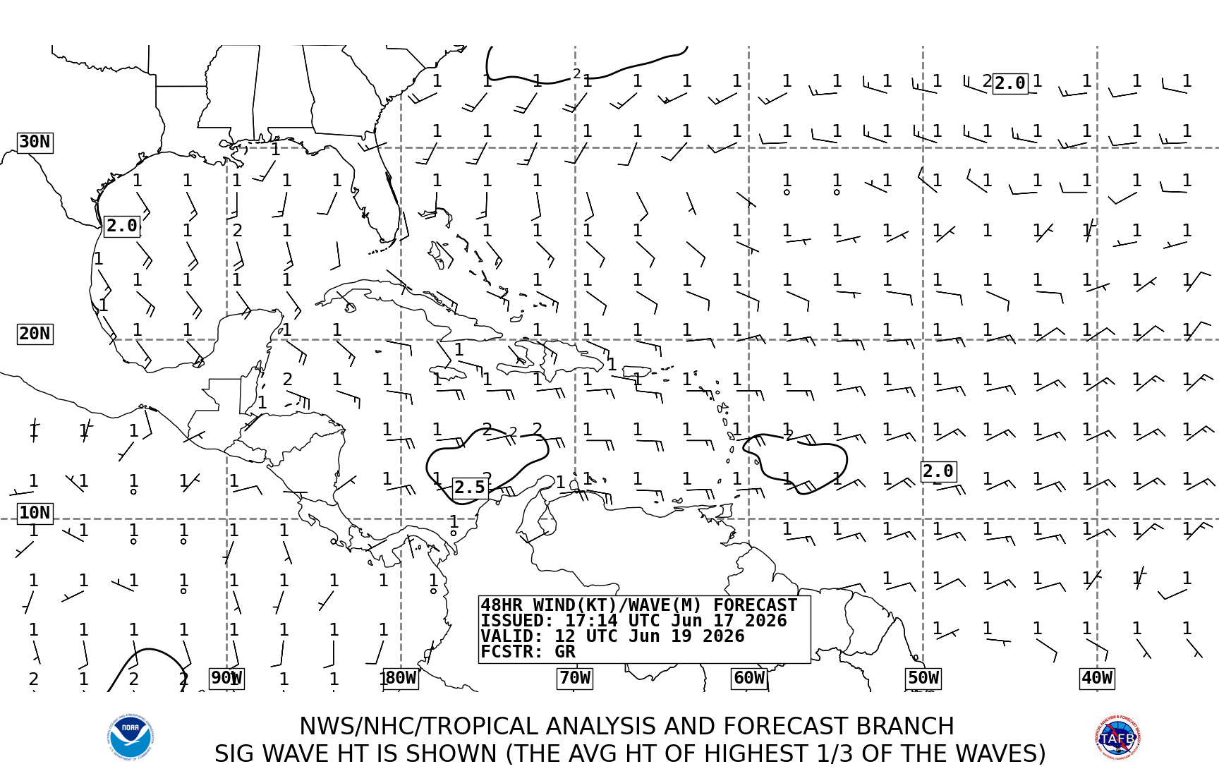
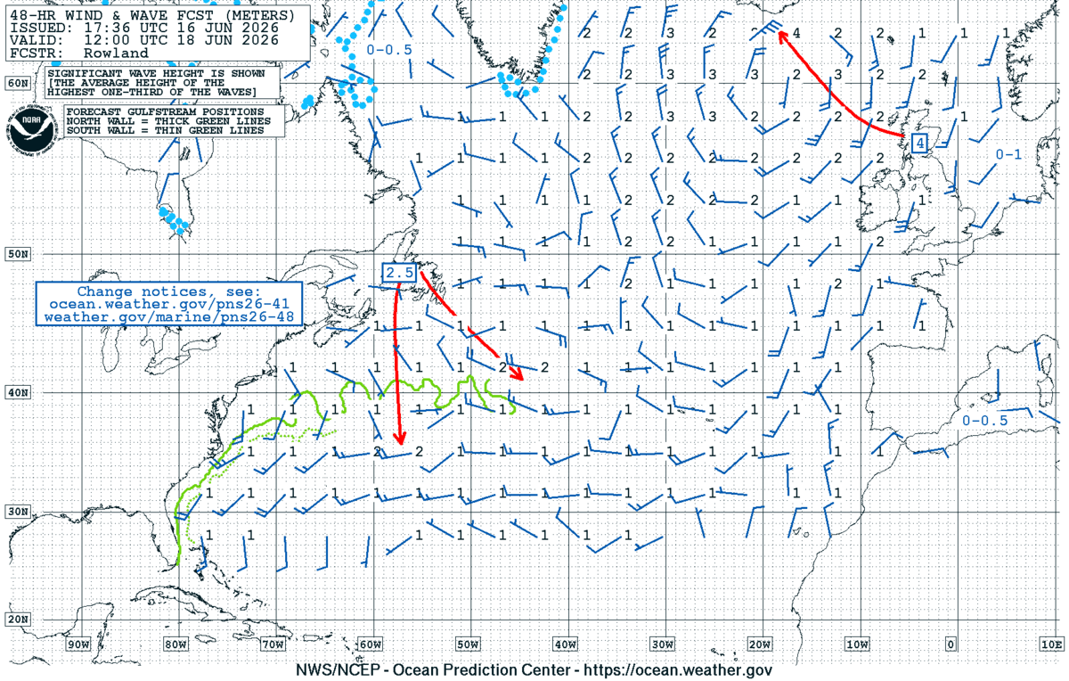
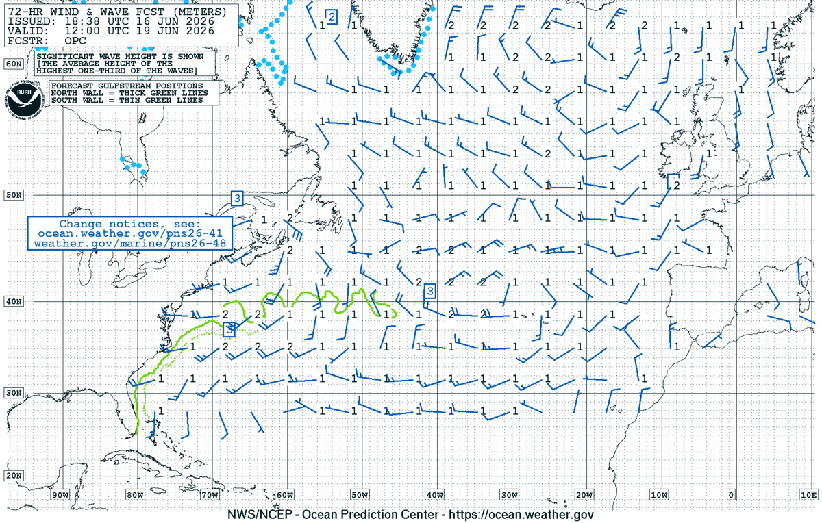
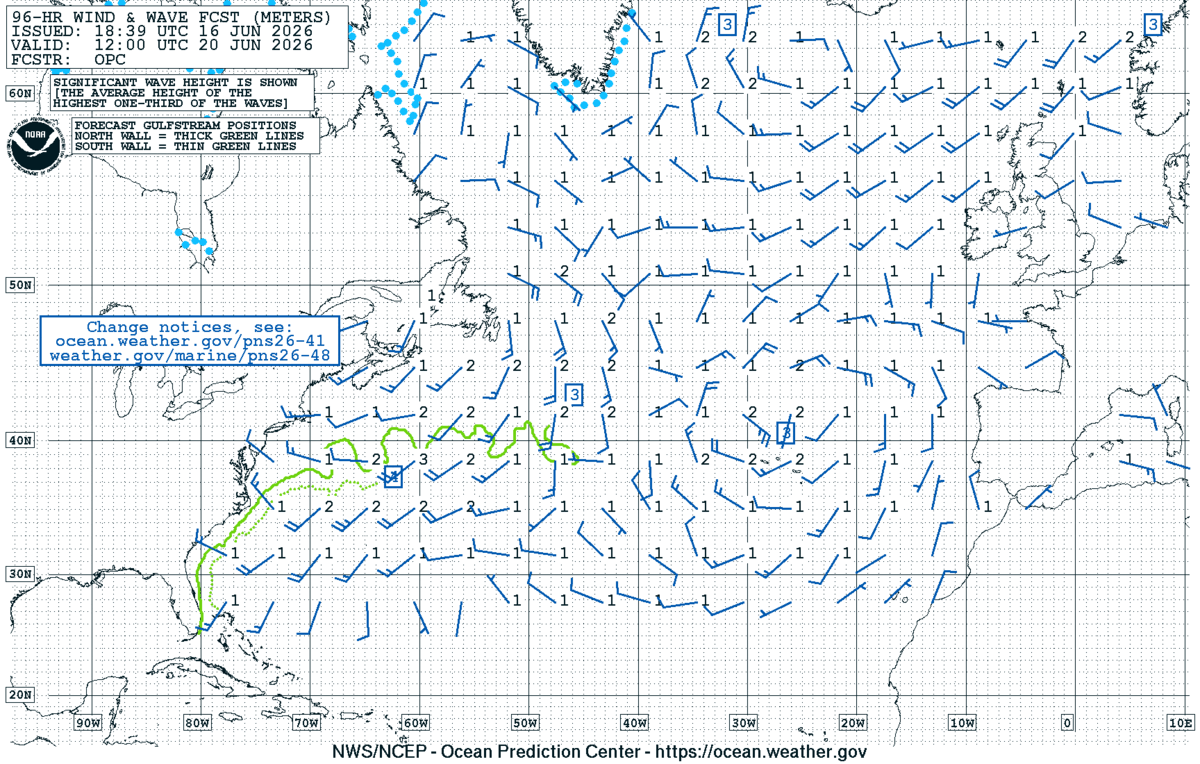
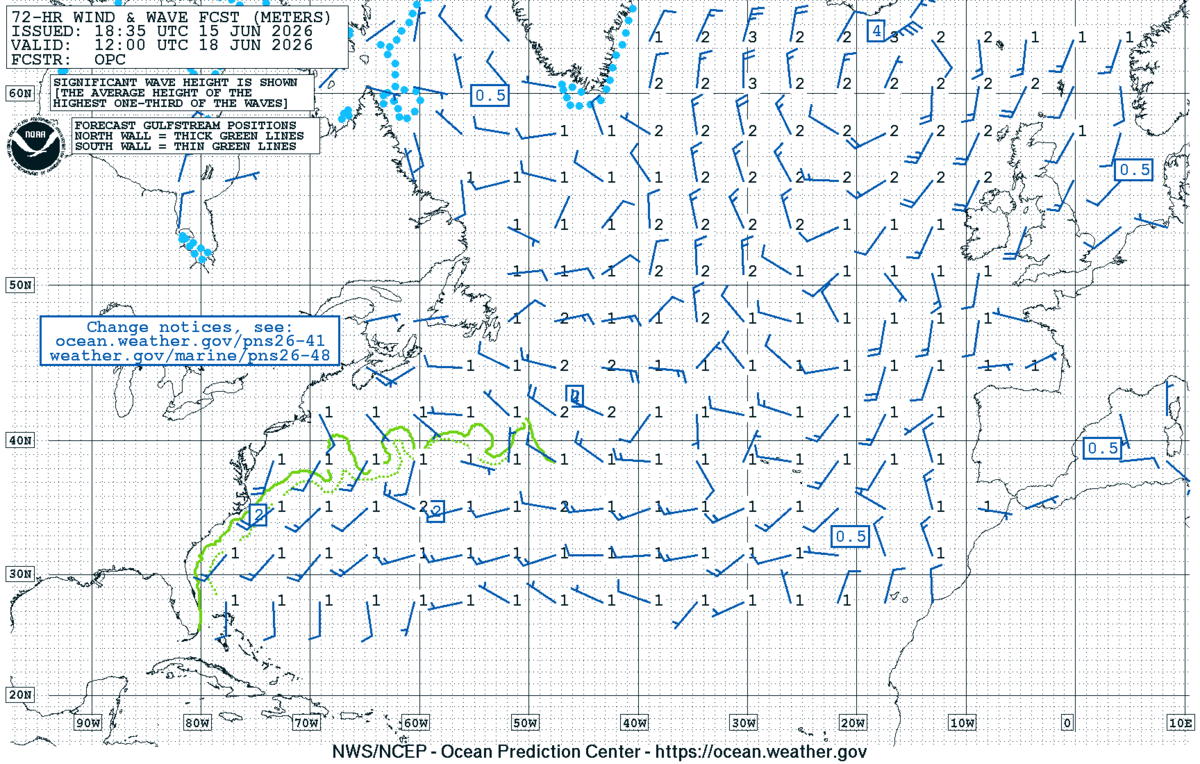
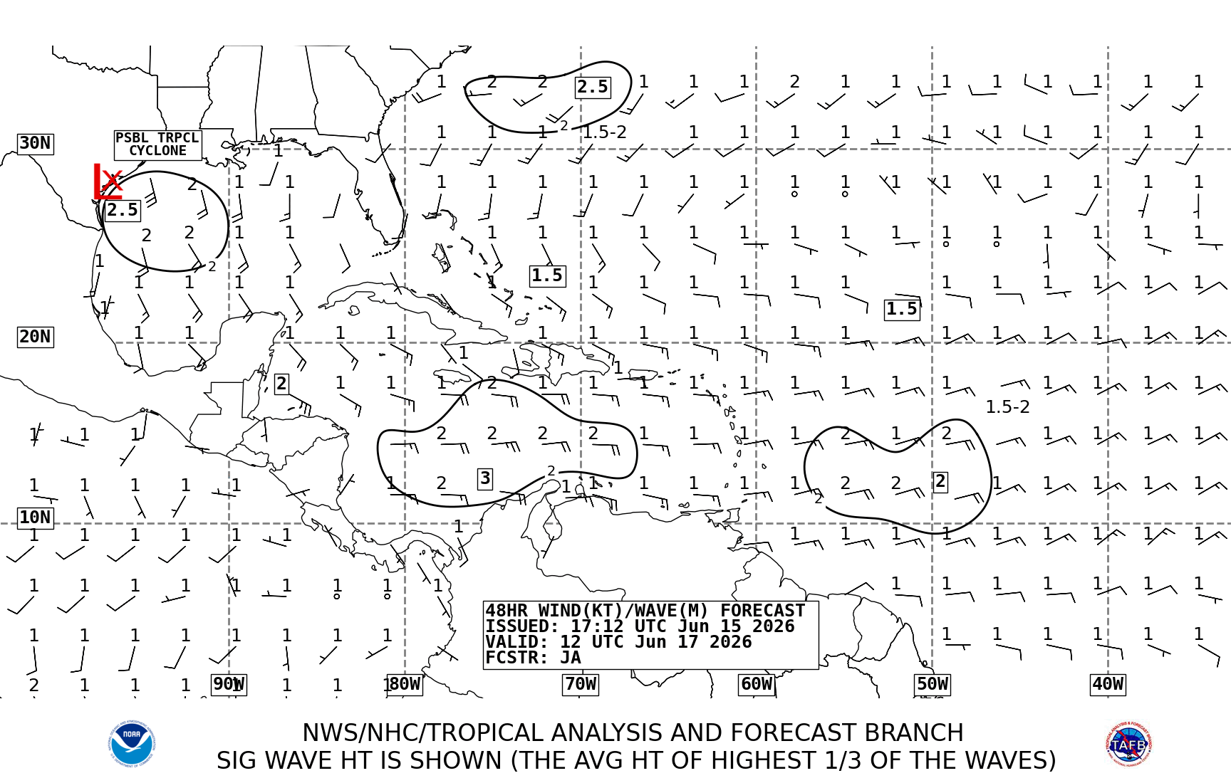
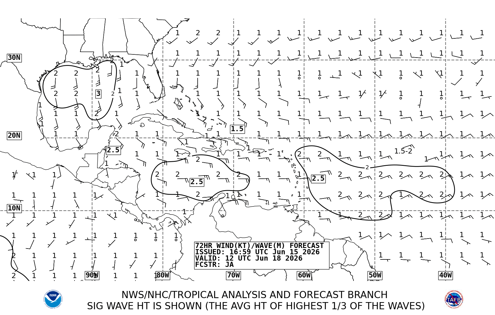
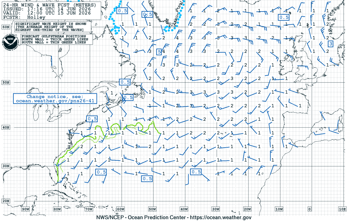
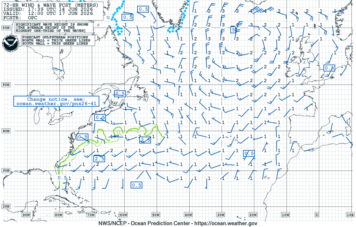
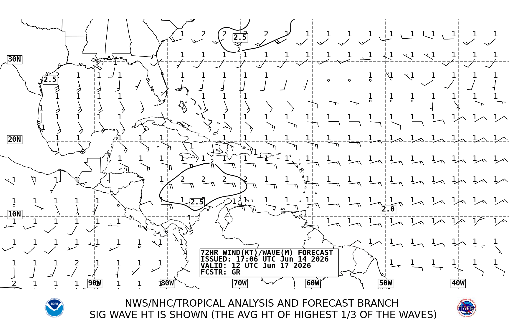
Day 1 (Sat 20 Jun) — Biscay leg. W–WSW 12–18 kt, locally 20 kt in outer Biscay. Seas 1.5–2.0 m from the W (Chart 7: "2" off NW Spain, "1.5" mid-Biscay). No fronts cross the route; cloud and showers stay north of 48°N.
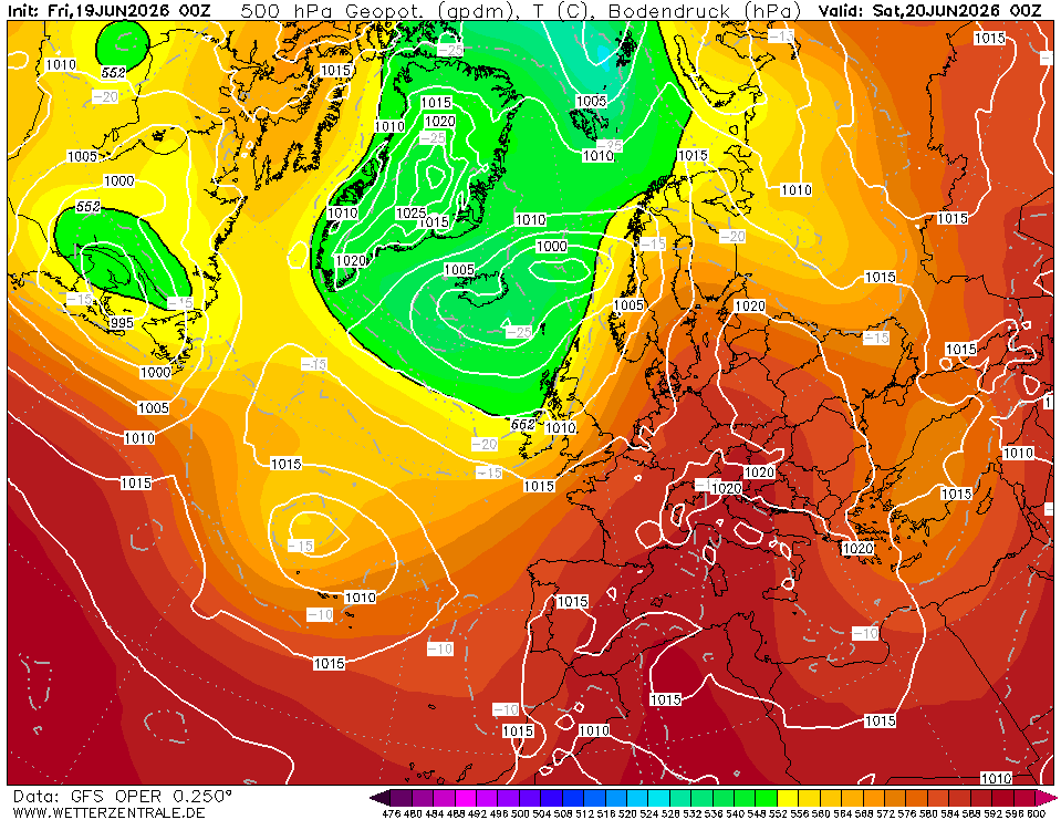
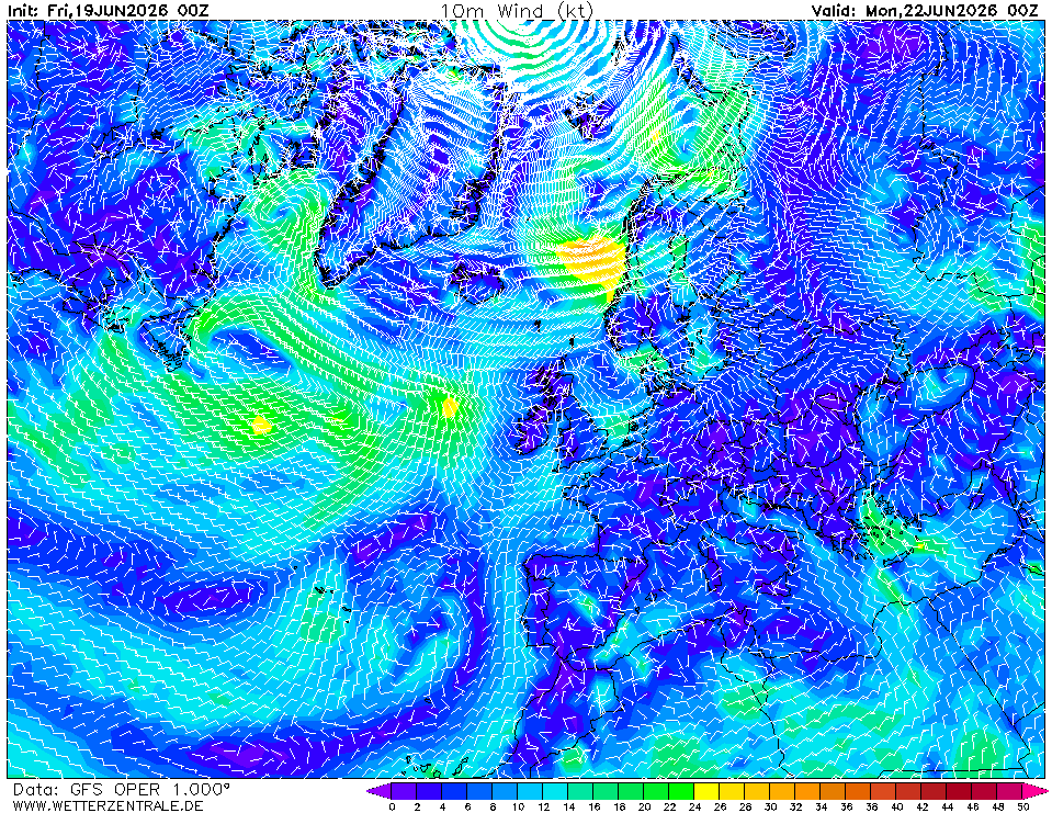
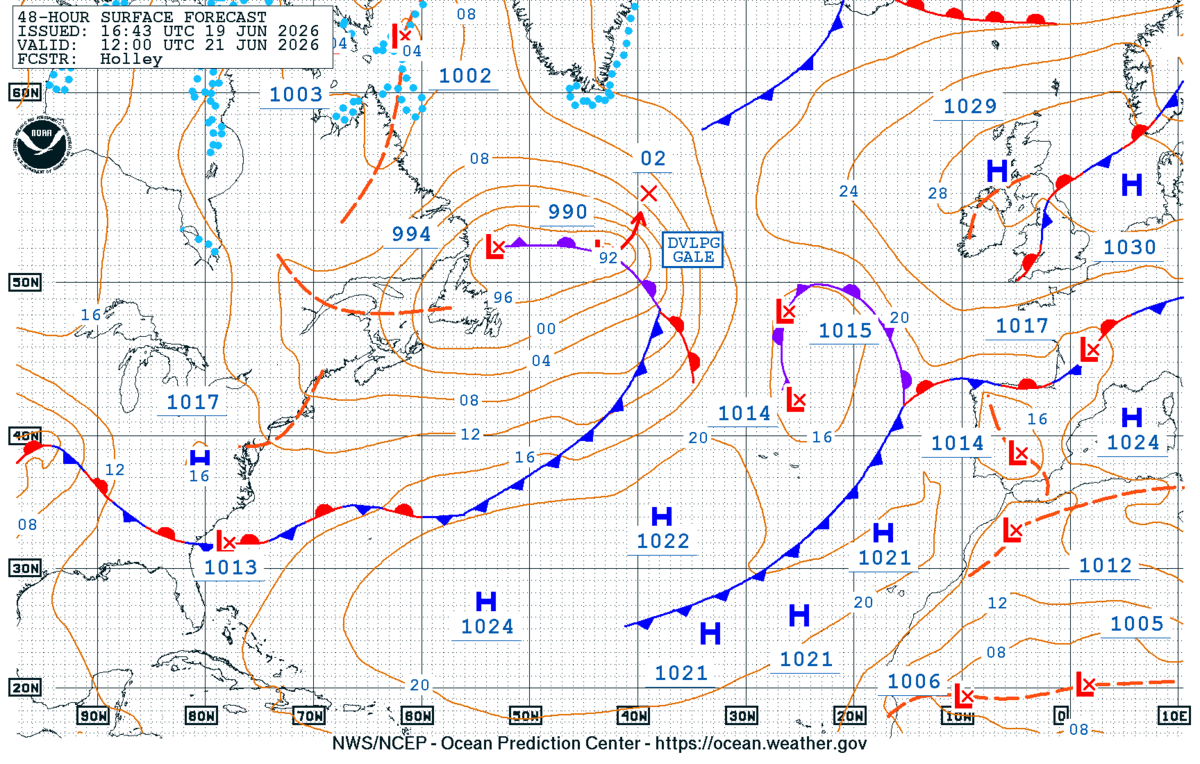
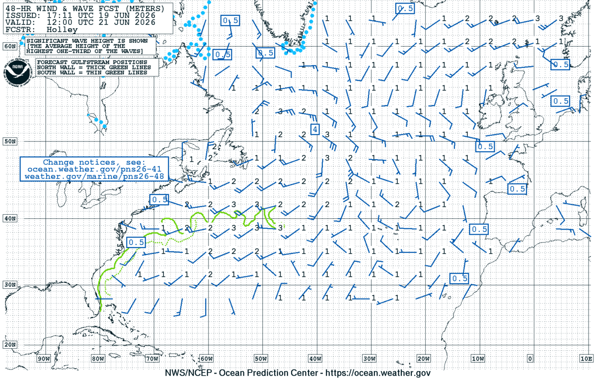
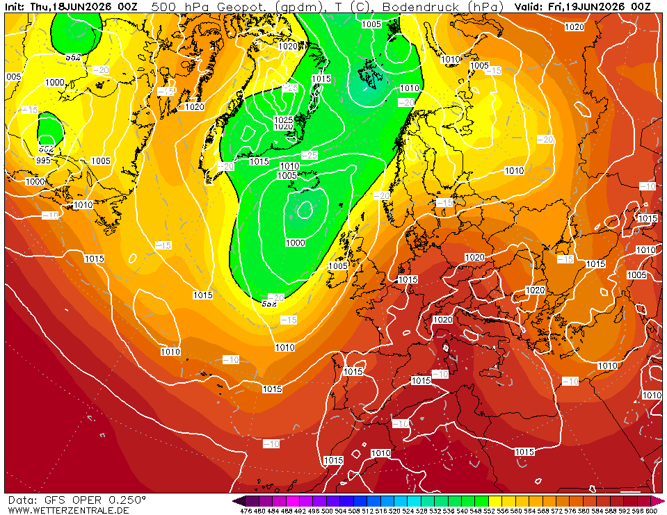
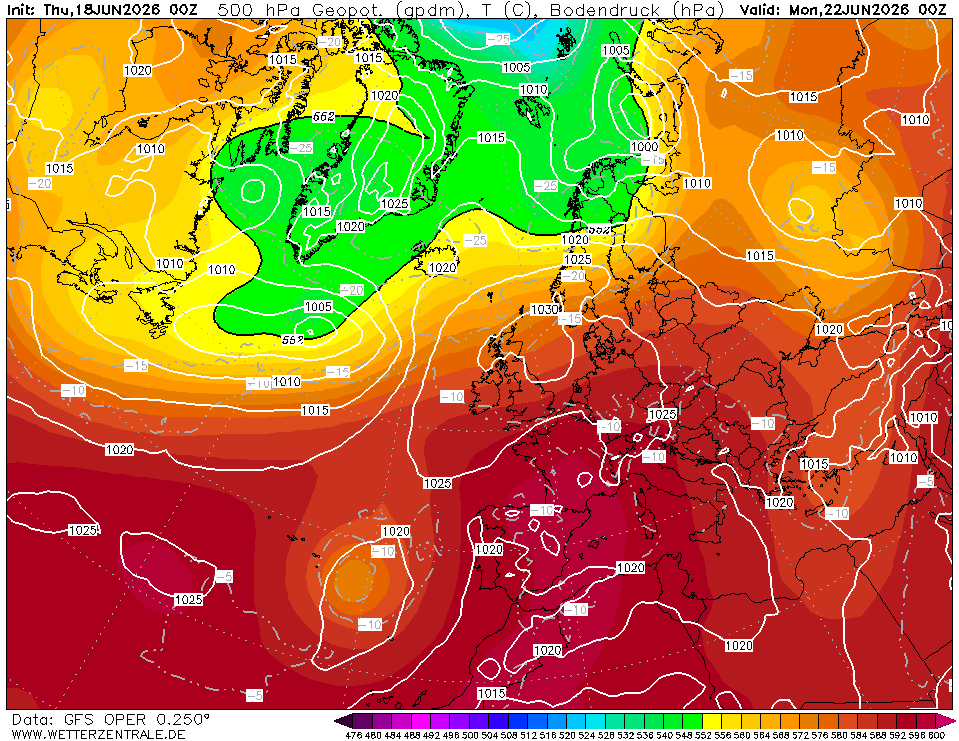
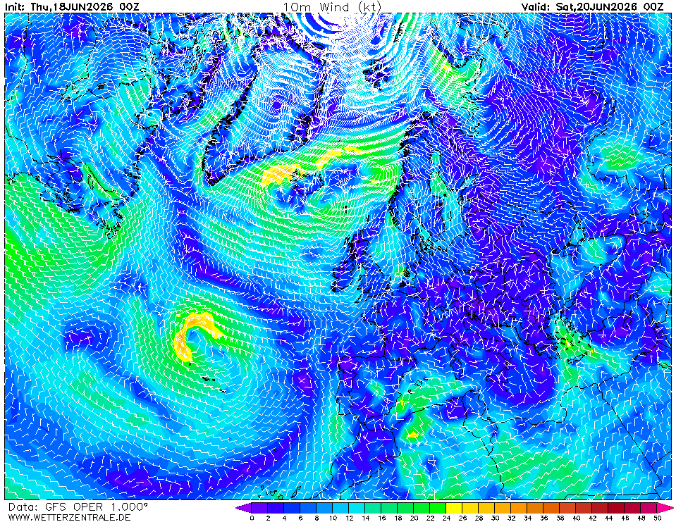
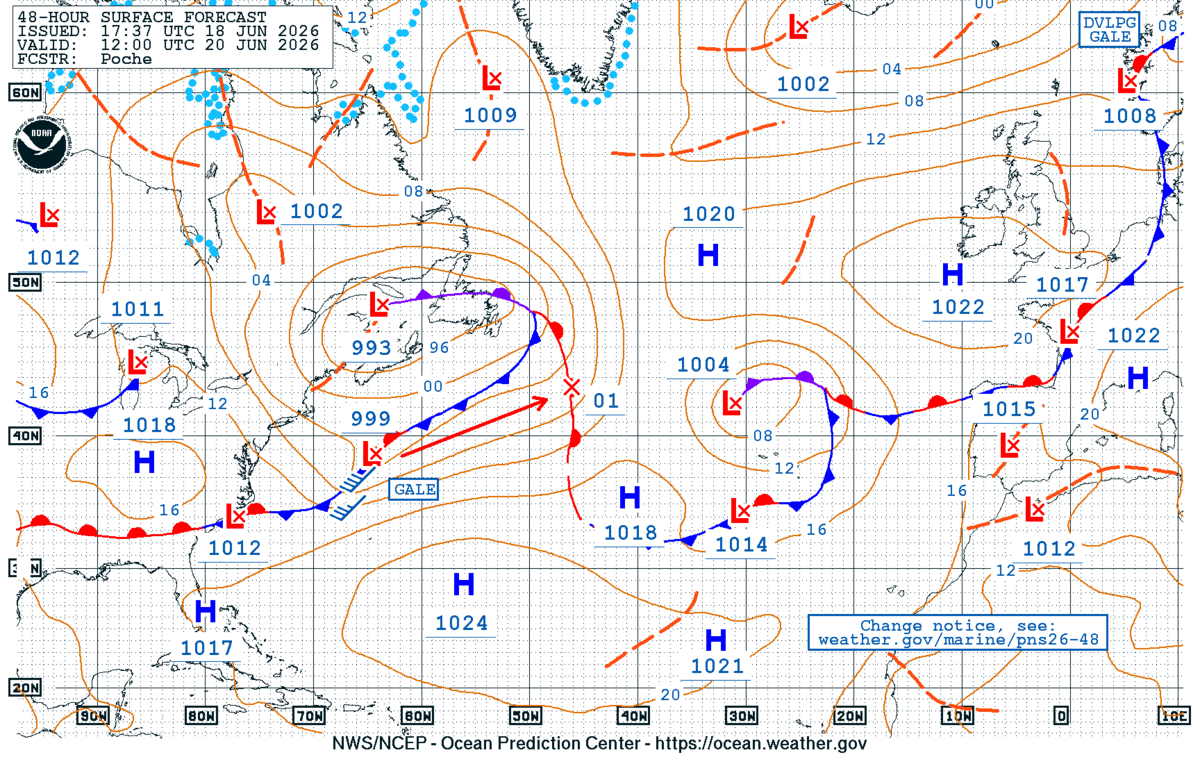
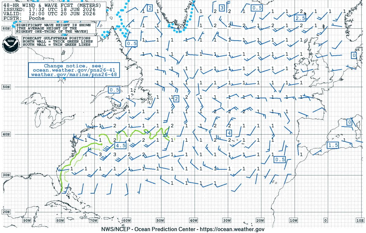
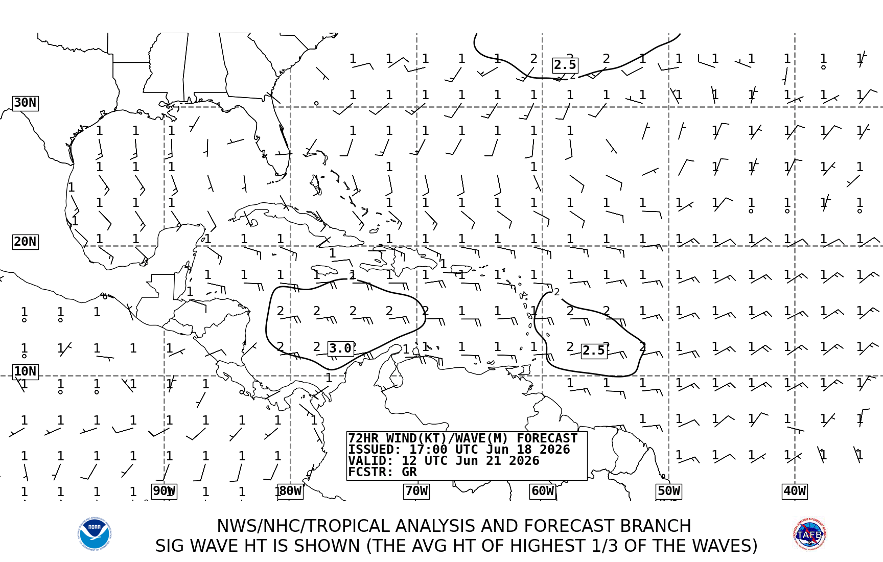
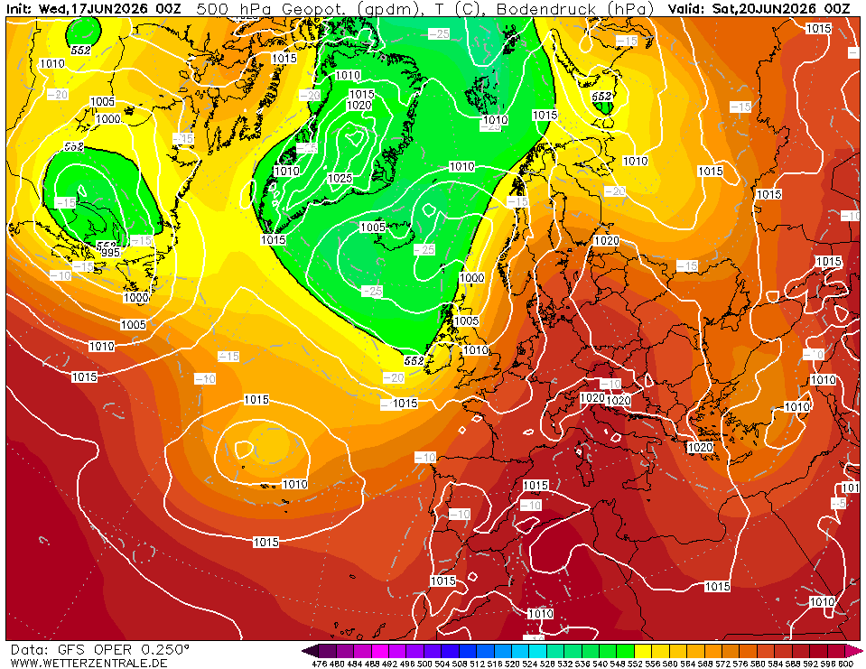
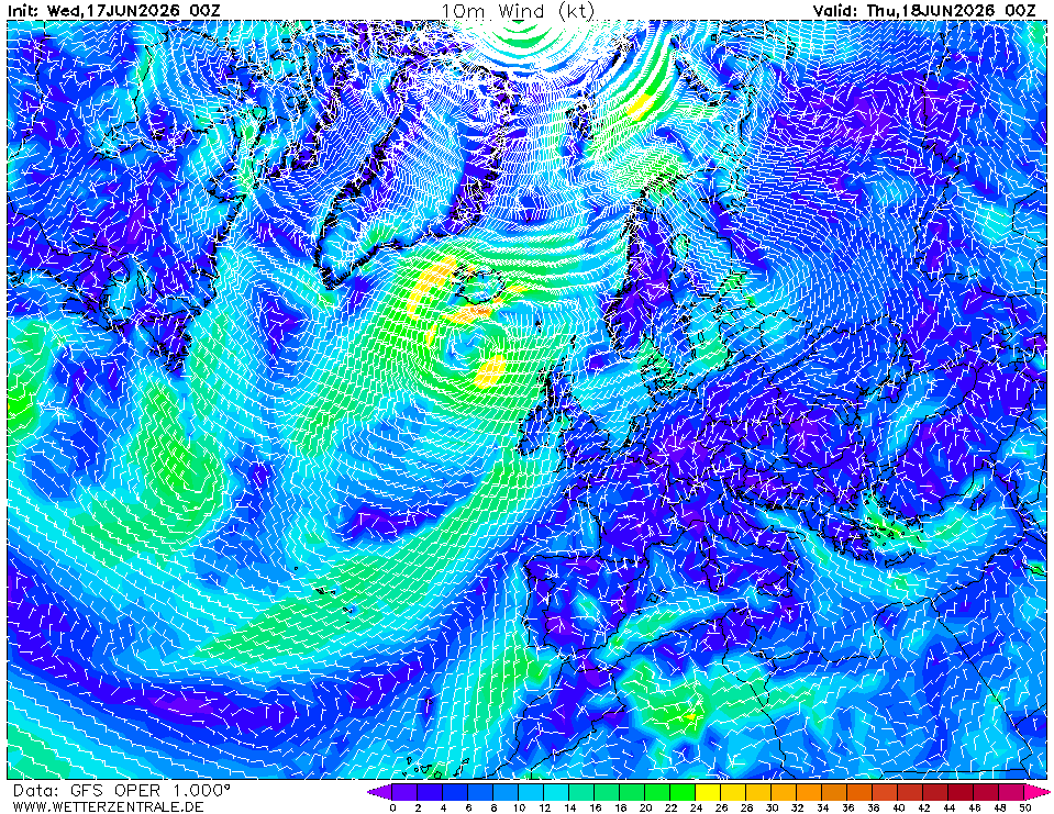
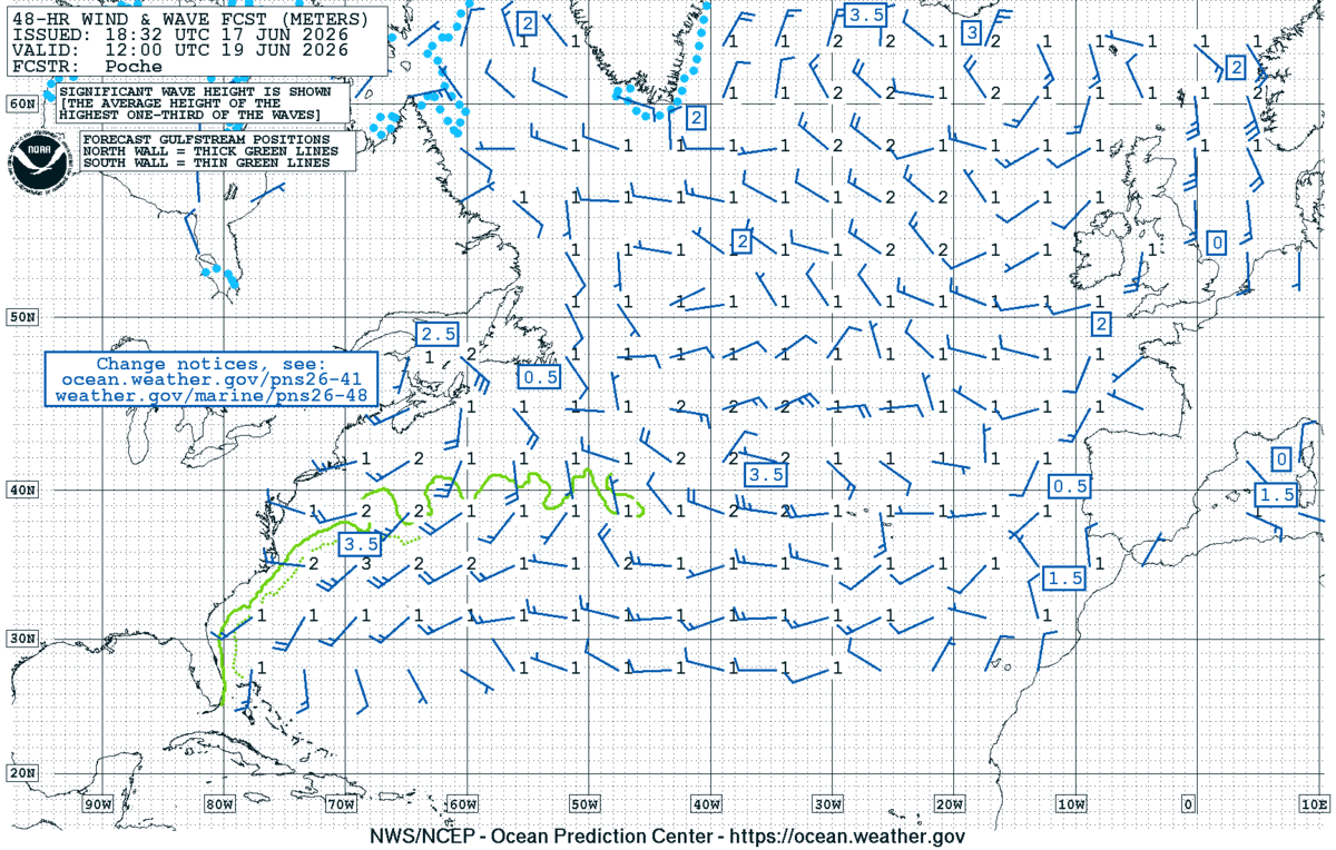
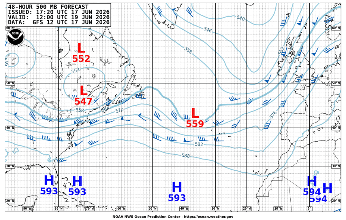
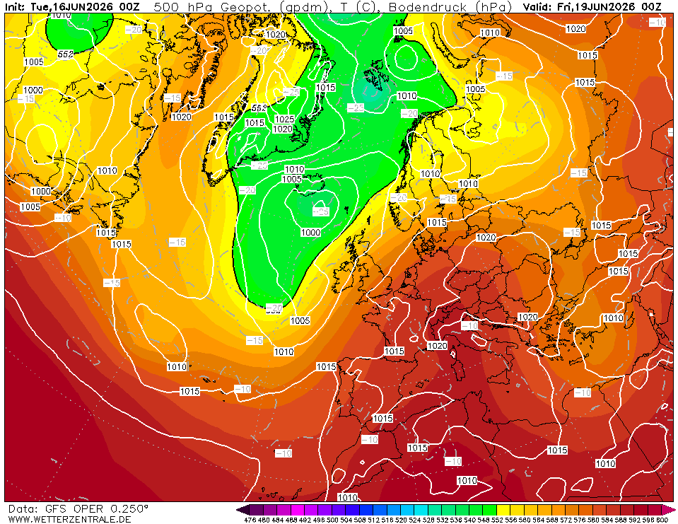
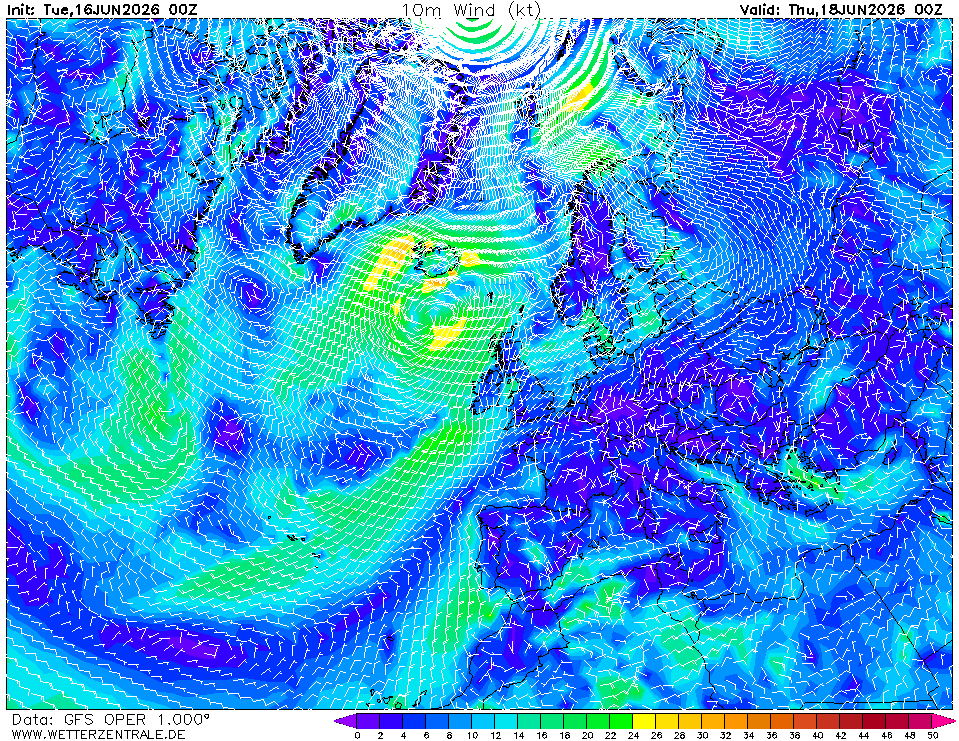
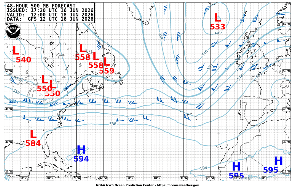
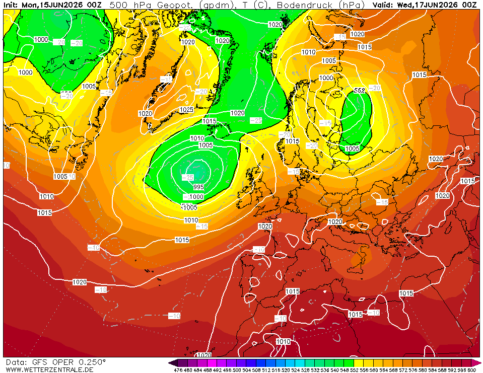
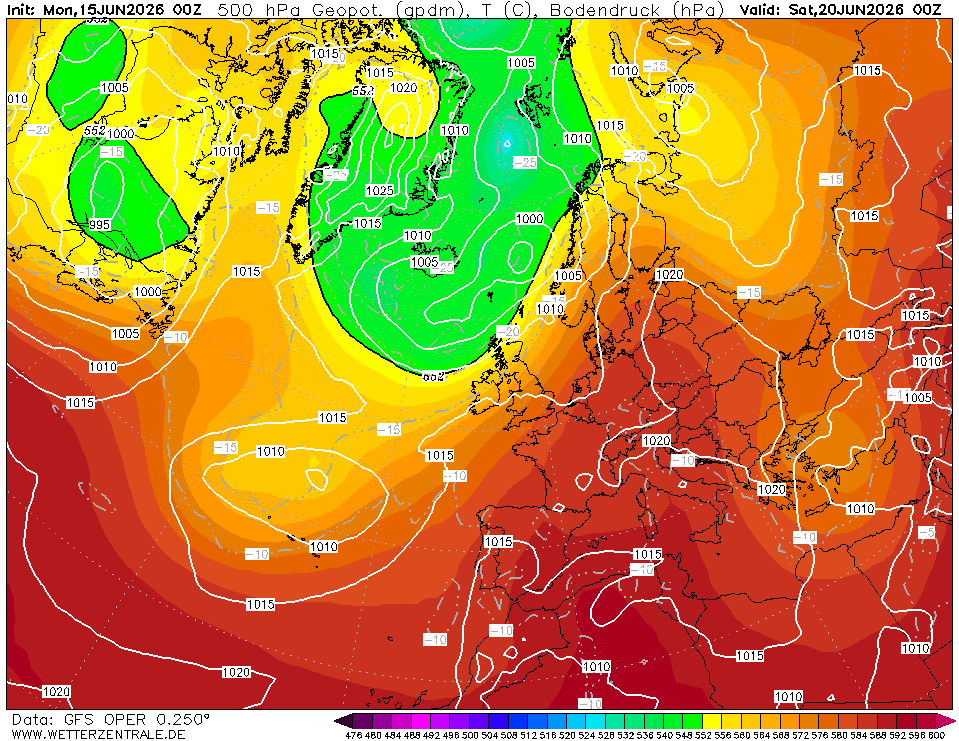
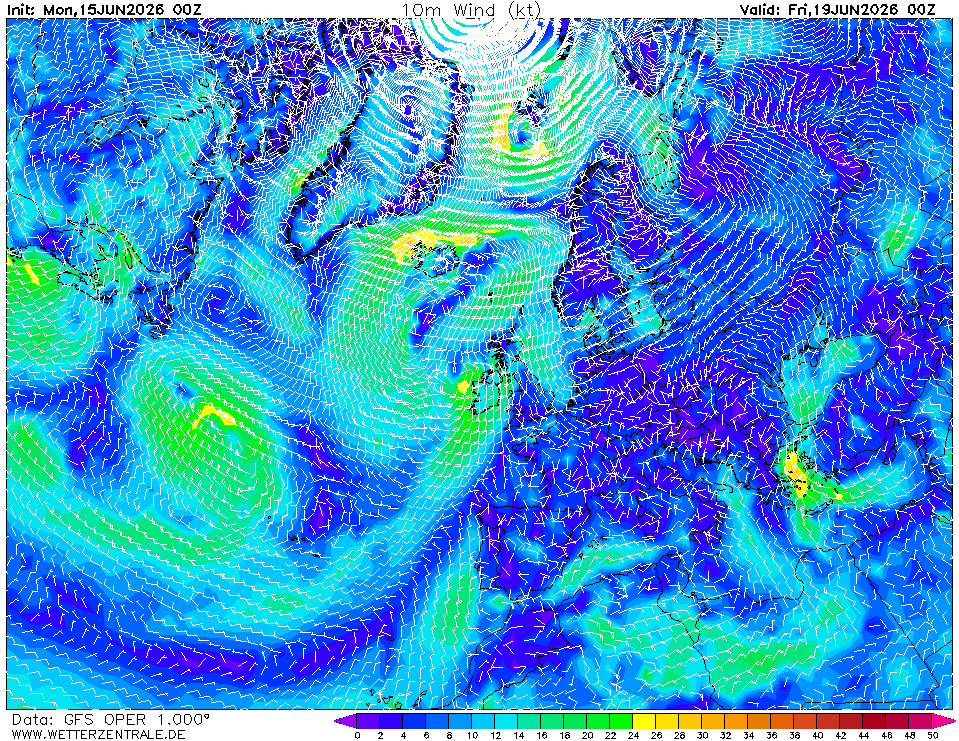
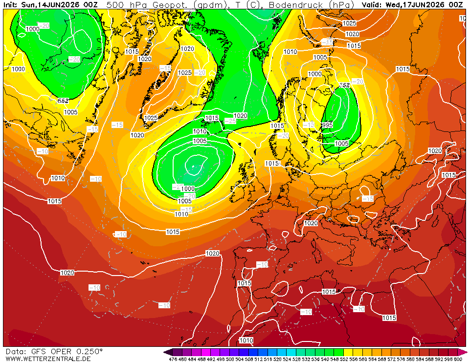
Day 2 (Sun 21 Jun) — Finisterre to off Lisbon. Ridge builds (1025 hPa over Iberia, Chart 2). N–NW 10–15 kt becoming N 15–20 kt as Portuguese trades set in south of Finisterre (Chart 5 shows the yellow 18–22 kt tongue along the Portuguese coast). Seas 1–2 m, NW swell. Excellent sailing conditions.
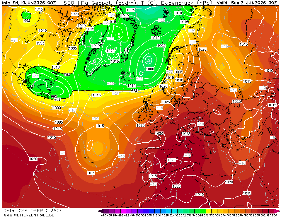
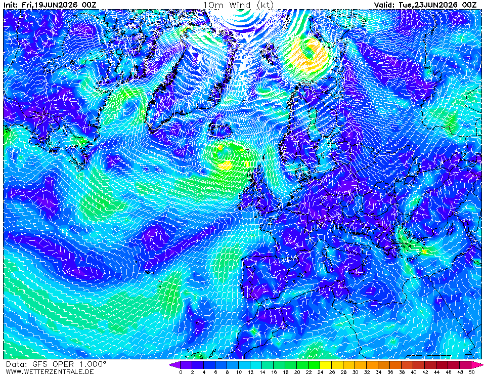
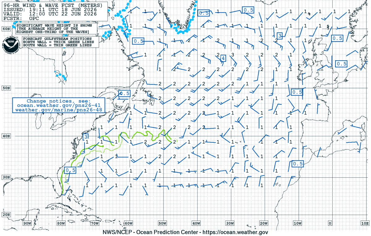
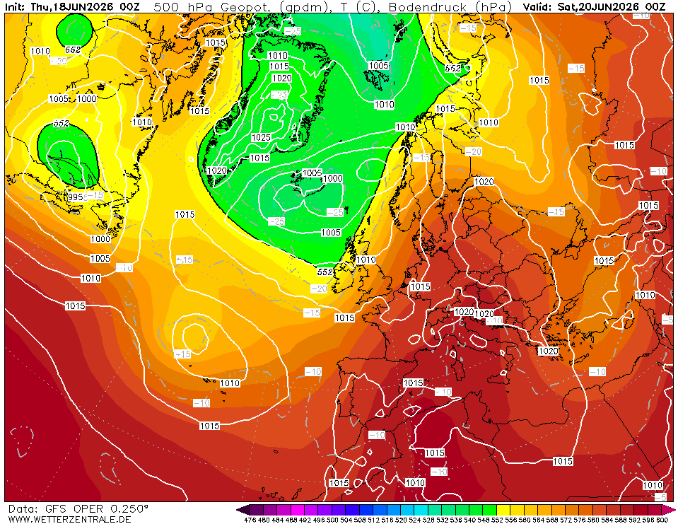
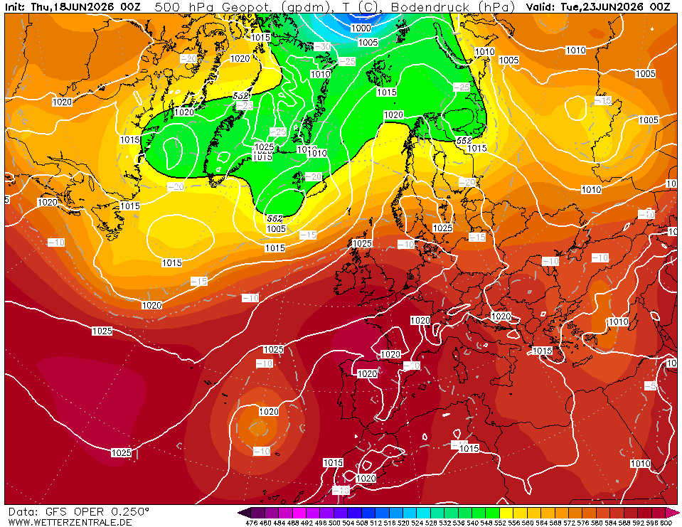
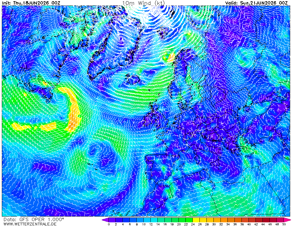
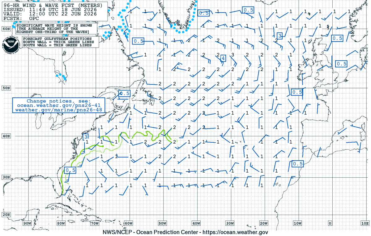
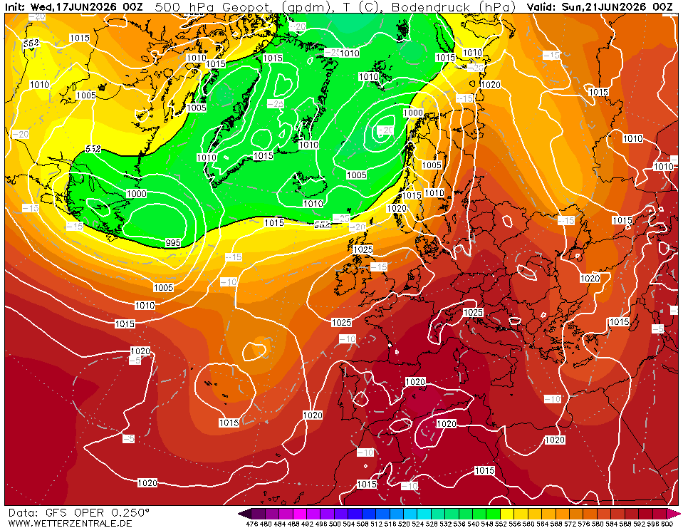
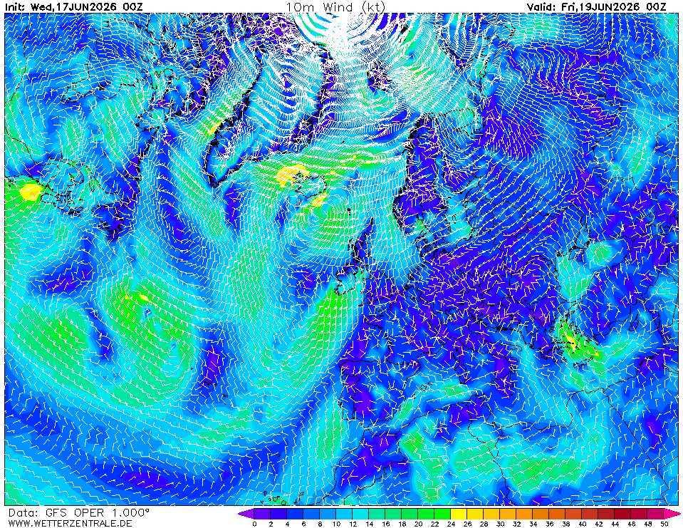
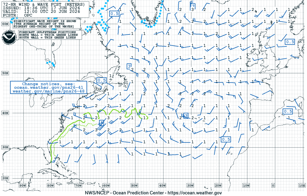
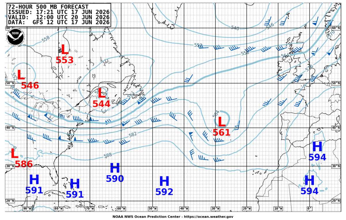
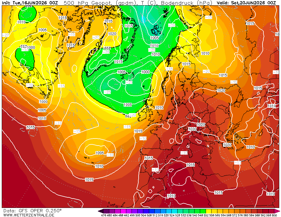
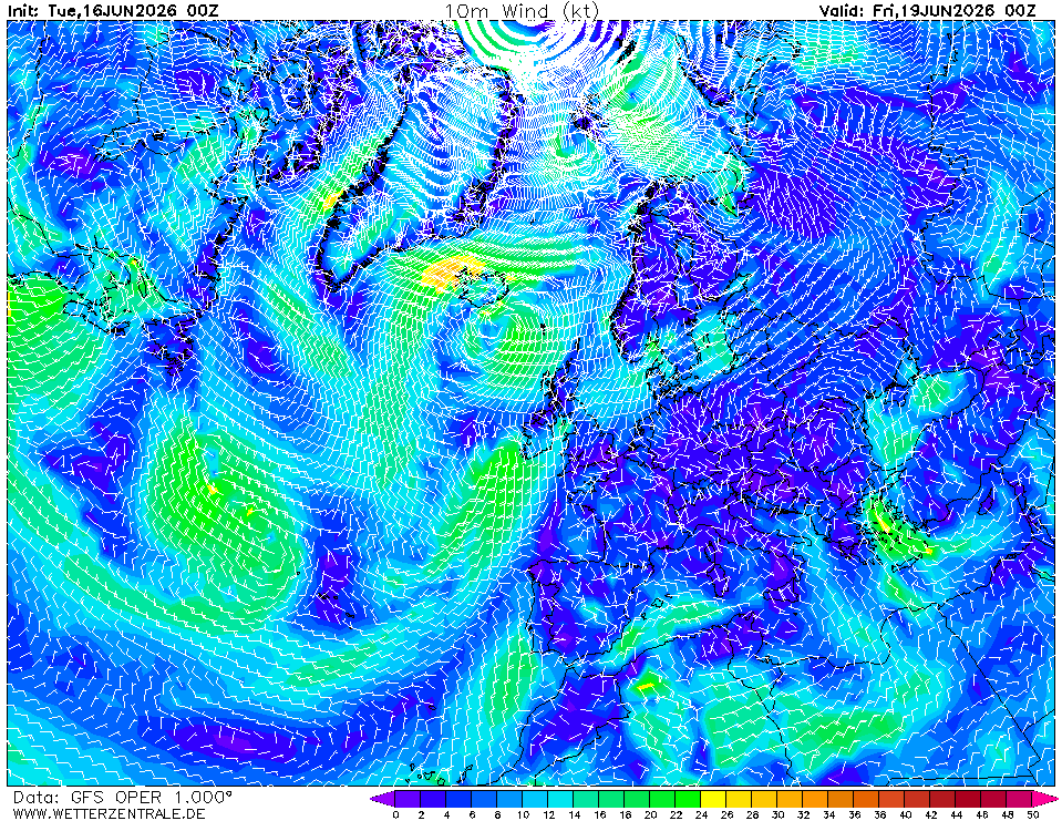
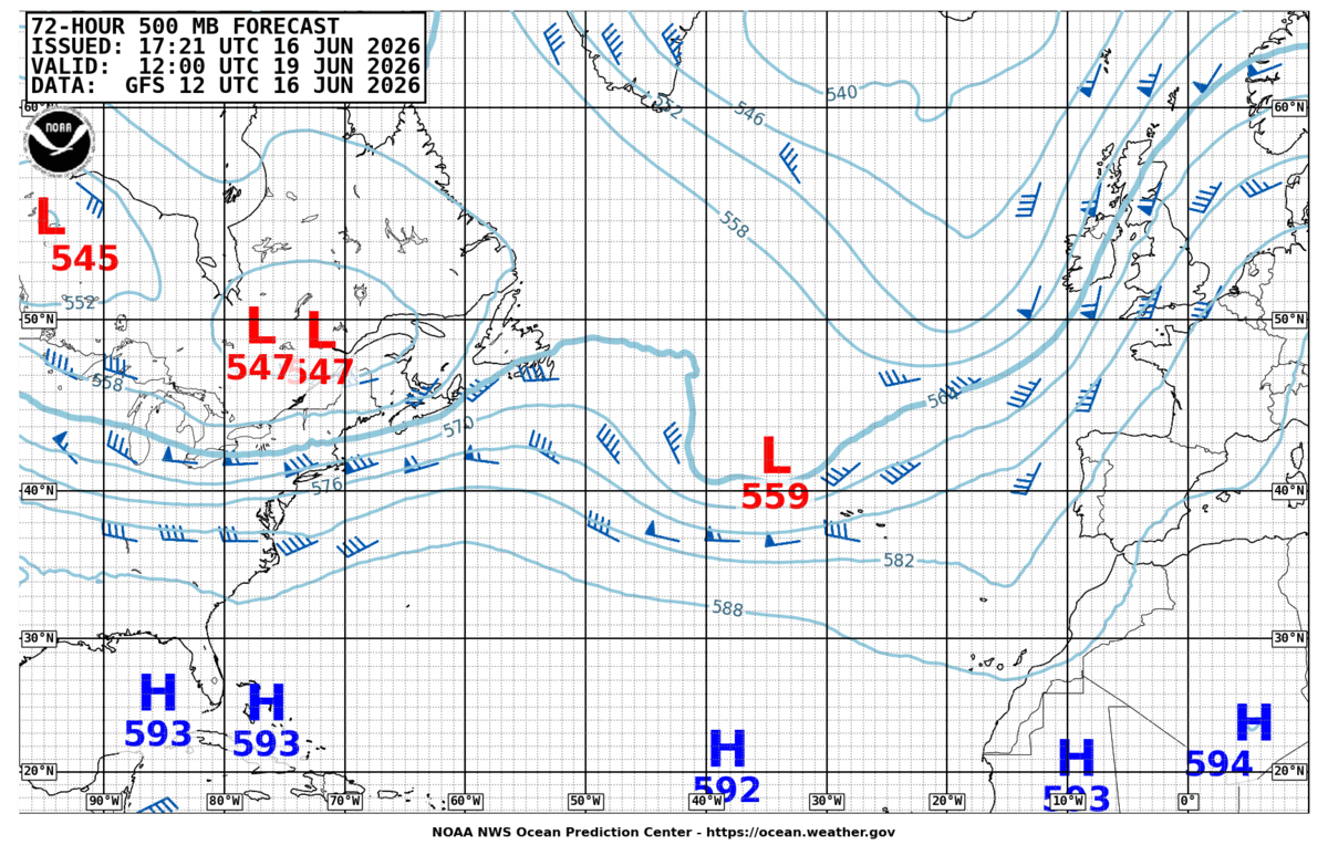
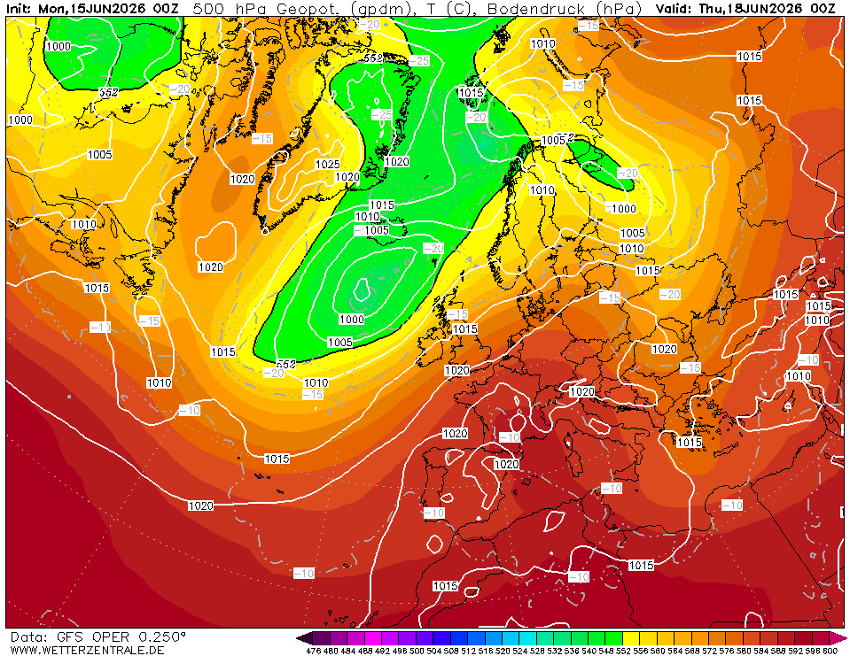
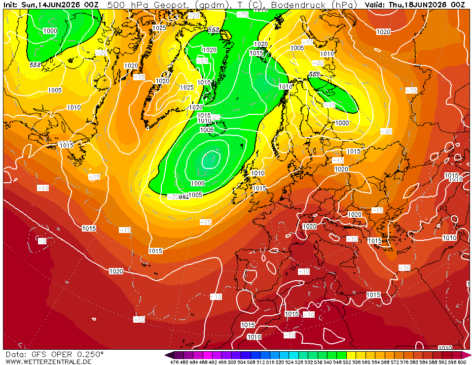
Day 3 (Mon 22–Tue 23 Jun) — Cape São Vicente to Gibraltar. Ridge axis shifts east, 1020–1025 hPa over Iberia (Chart 3). N–NE 15–20 kt off the Algarve, easing to E 10–15 kt approaching the Strait. Seas <1.5 m. Expect a typical easterly Levanter signature building in the Strait approach.
Top 3 risks to watch
- Portuguese coast acceleration zone. Chart 5 shows 20+ kt squeezing between the Iberian thermal low and the ridge. Uncertainty: peak strength and how far offshore it reaches. Trigger: if buoy/forecast shows >25 kt sustained N of Lisbon, stand 40+ nm offshore.
- Levanter at the Strait. Charts 2–3 show pressure rising over Iberia and weak gradient toward the Med — classic E'ly setup. Uncertainty: onset timing and strength. Trigger: Tarifa forecast >25 kt E, delay Strait entry or stage at Barbate.
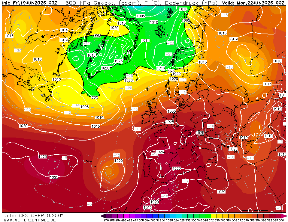
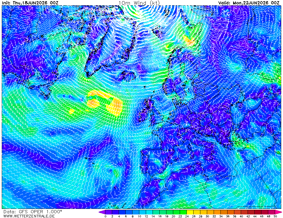
- Iceland low's trailing front. Chart 1/2 show the system slow but deepening trough. If it digs south faster than modelled, a front could clip outer Biscay Day 1–2. Trigger: falling pressure at Ouessant + backing wind beyond SW = accelerate south.
Routing considerations
Window is open — depart on the planned schedule. The Azores ridge is the controlling feature and it's strengthening, not eroding. Aim to clear the Chaussée de Sein within 18 hrs to use the W'ly Day 1 before it backs. Favour a rhumbline track to ~45°N 4°W, then offshore of Finisterre (stay outside the TSS, 25 nm off) to exploit the N'ly on Day 2 with the wind on the quarter. South of Cape São Vicente, hug the Algarve coast (10–15 nm) to soften any Levanter build and stage your Strait transit for a slack/west-going tide window. If the Iceland low surprises south, favour the southern semicircle — keep west of any forming low, never let it overtake you to the north.
Advisory only — verify against GRIB updates, Navtex, and OPC bulletins underway.